 The next morning, I cleared my email, while Cheryl studied the instructions for her SLR camera. The cable from the power supply for my computer had been fraying at the hard, sharp plastic nipple where it entered the power supply, and I was unable to reconnect the wires when it finally broke. I packed up my tablet after it ran down. Cheryl did not have cell coverage, so I resigned myself to being without a computer until we returned to civilization and found a Wifi spot, where I could order a new charger.
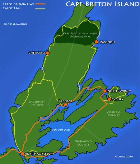
We enjoyed smooth roads and tailwinds up Highway 19 all the way to Mabou, where we picked up the Cabot Trail. We found breakfast at a so-called tearoom and bakery. Everything was cooked in shortening. I was already missing the food in Québec.
The clouds were darkening and the tailwinds were picking up as we rode towards the Glenora Distillery. 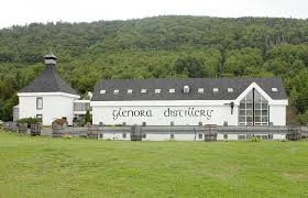 We beat the rain to the distillery, where we enjoyed a glass of the local Big Spruce Stout while waiting for a tour to start. Glenora is the only North American maker of single-malt whisky with product on the shelves, and the ten-year-old product that we tasted was worthy of the finest Scottish tradition.
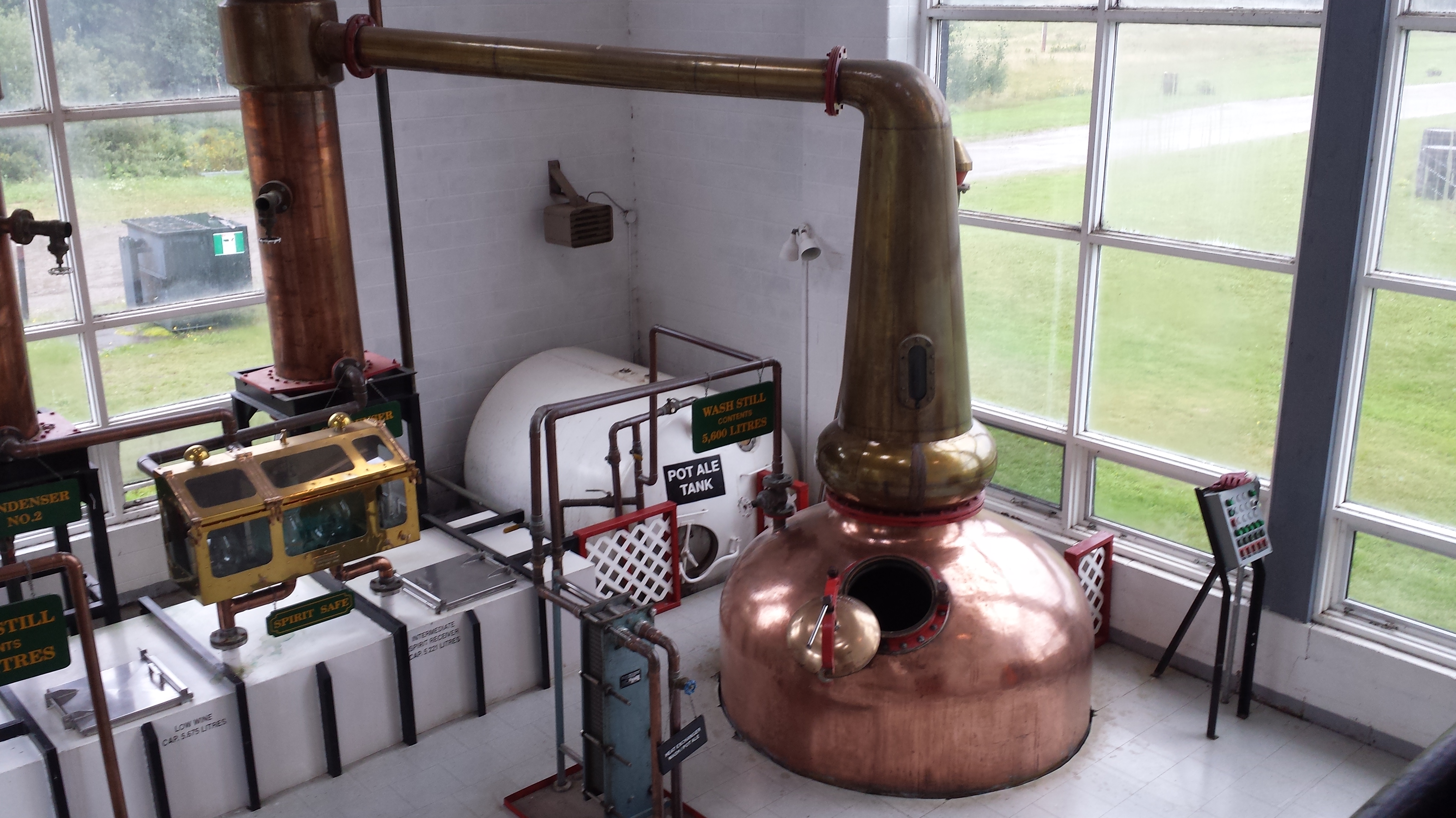 The squall blew over while we were touring the distillery. We found an early supper at the Coal Miner’s Café in Inverness. With its redneck theme, I was surprised that they had olive oil for my salad. We enjoyed dessert at a new coffeehouse next door, where two women were launching an upscale establishment ahead of what will be a renaissance of Inverness when a new Scottish links golf course opens next May.
The MacLeod Campground was so far off the beaten track that we almost gave up looking or it. The office was closed when we got there. As darkness fell, we picked a lovely spot overlooking the beach, and pitched our camp. The grounds were occupied mainly by long-term RV residents.
The next day (4 September), we entered the Cape Breton National Park just after lunch. 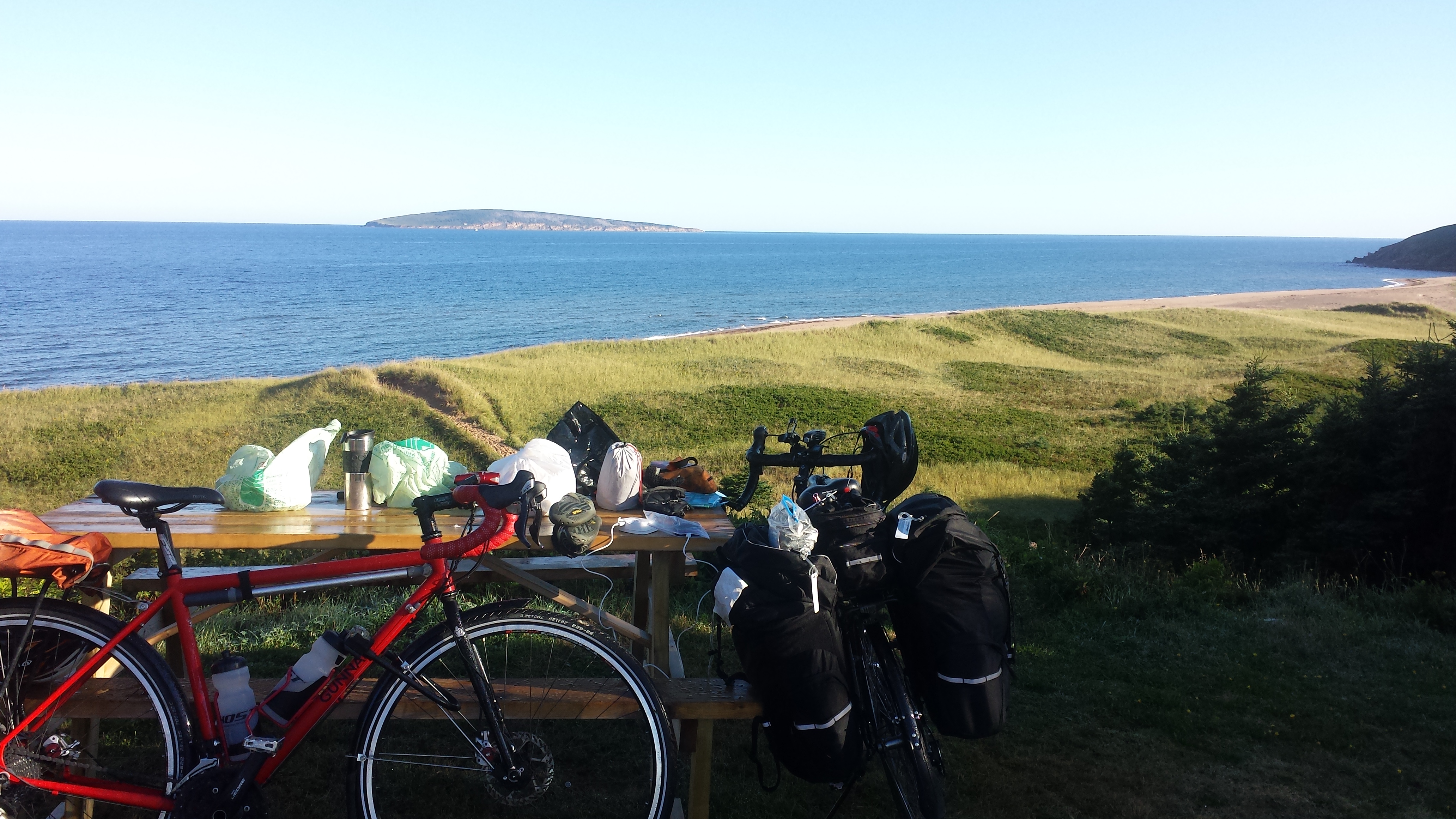 For the next three days, we would both face our greatest challenges ever. More than once, we reached our individual cardiac envelopes.
 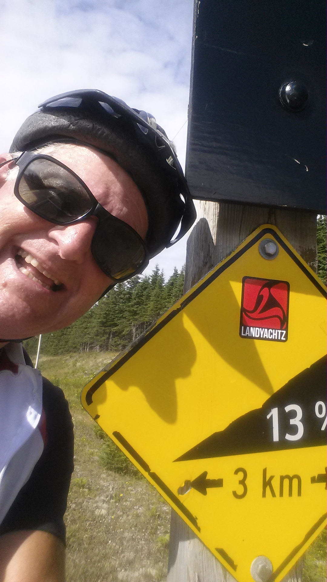 The long climbs, like French Mountain (6 km at 11%) or North Mountain (3 km at 13%) were not as hard as some of the 1-km rides up grades exceeding 14%.
Of course, climbing steep mountains included terrifying downhills. We rode down a 17% grade into Pleasant Bay. On another patch of well-paved straight road, I set a personal record, flying downhill at 79.98 km/hr.
Near the north shore of the Cabot Trail, we enjoyed a wonderful break by taking the Coastal Cabot Trail, an alternate loop that allowed us to discover a long, isolated spit of sand extending into Aspy Bay. Winding cliffs plunged into the sea to our west, while forests fell into the water away to the east. It was one of those places on earth where the wall between the material and spiritual worlds grows thin. We hated to leave.
 As if to match our reluctance to leave, the road conditions deteriorated, with potholes so big that we could almost not ride across them. We were exhausted when we arrived in Ingonish to find that the Ingonish Campground had closed for the season. So had the restaurant.
  But the Keltic Lodge at the end of the road had a lovely cottage overlooking Ingonish Bay available, with a four-star restaurant at the Lodge, and a buffet breakfast included. We showered, changed, and enjoyed a delightful meal, followed by a good night’s sleep in great comfort.
On 6 September, we loaded up at breakfast, and it served us well, because a long day lay ahead. The southerly winds that had pushed us up the Trail on the eastern side of the island were now against us. There was a sharp, right-angled rock face on the road coming down the very steep grade around Cape Smoky. 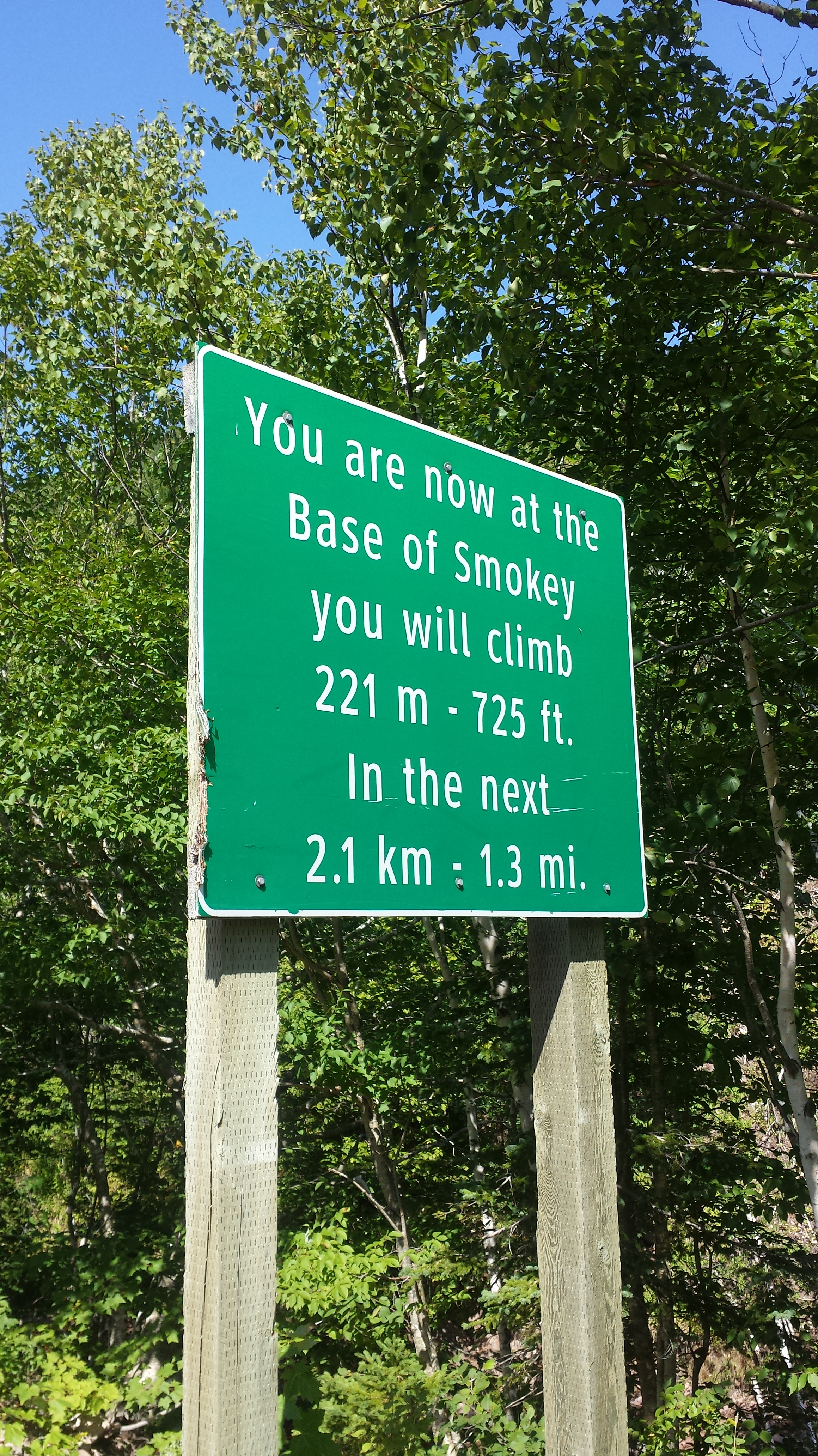 The wind was dropping into a crevasse, piling up against the south side of the rock, then whipping around the corner at gale force. It took all my skill and concentration to ride into the wind, but I still could not round the corner. I straddled my bicycle, unable to look behind me to check on Cheryl, or even dismount to walk. A sudden drop in the gale let me slip around the edge of the rock and continue the hair-raising descent into the wind on the south face. I came to a stop at the bottom and waited for Cheryl to make her way down. After 20 minutes, I began to worry. Just as I began to walk back up, a van came down, and the occupants realized that I must have been Cheryl’s companion.
“She made it around,” the passenger shouted out the window as they drove by. “She’s coming.”
Indeed, when Cheryl did arrive, I found that she also had been unable to get around the corner, even walking. She never got a break in the gale. Instead, she clung to her bicycle, unable to move, until a carload of passersby stopped to help her. The men who thought they would walk the bike around the corner were almost blown off the cliff themselves. In the end, they put her in the car, and used the car to shield one of the men, who walked the bike around the corner. She remounted and joined me.
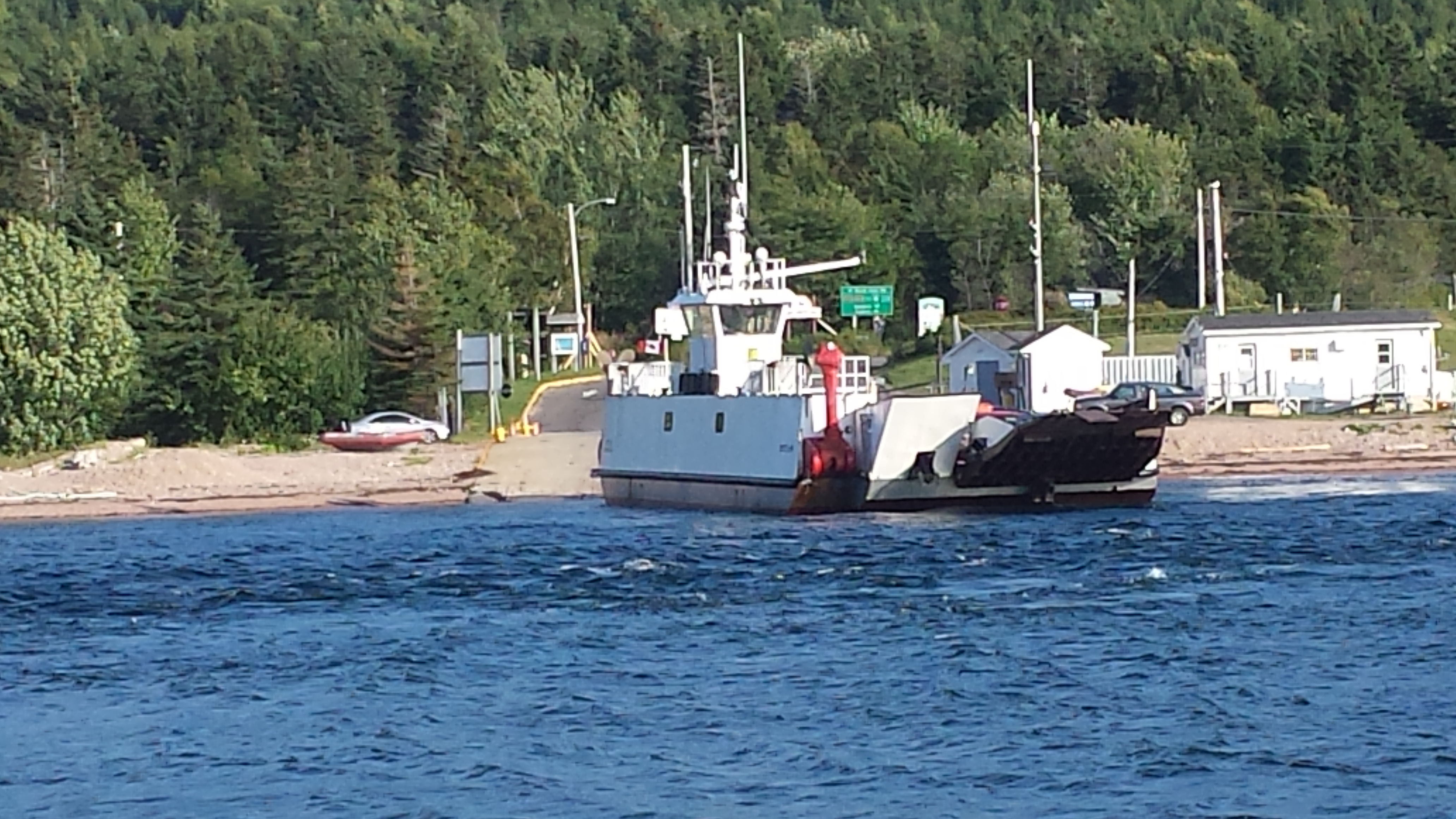 There was no way that we could make it all the way to the ferry at North Sydney that day. We caught the cable ferry to Englishtown late in the day. Dinner included entertaining conversation by the gregarious Captain Capers, who ran the Fish-and-Chips truck near the ferry. We spent the night in the campground on the ridge behind his truck. The climb to the ridge was so steep, that we had to push our bicycles up the loose dirt driveway. As we checked in and found our campsite, one of the RV families was putting on free corn and bread for everyone, and invited us over for some hot food. A pleasant note for the end of a day with great ups and downs.
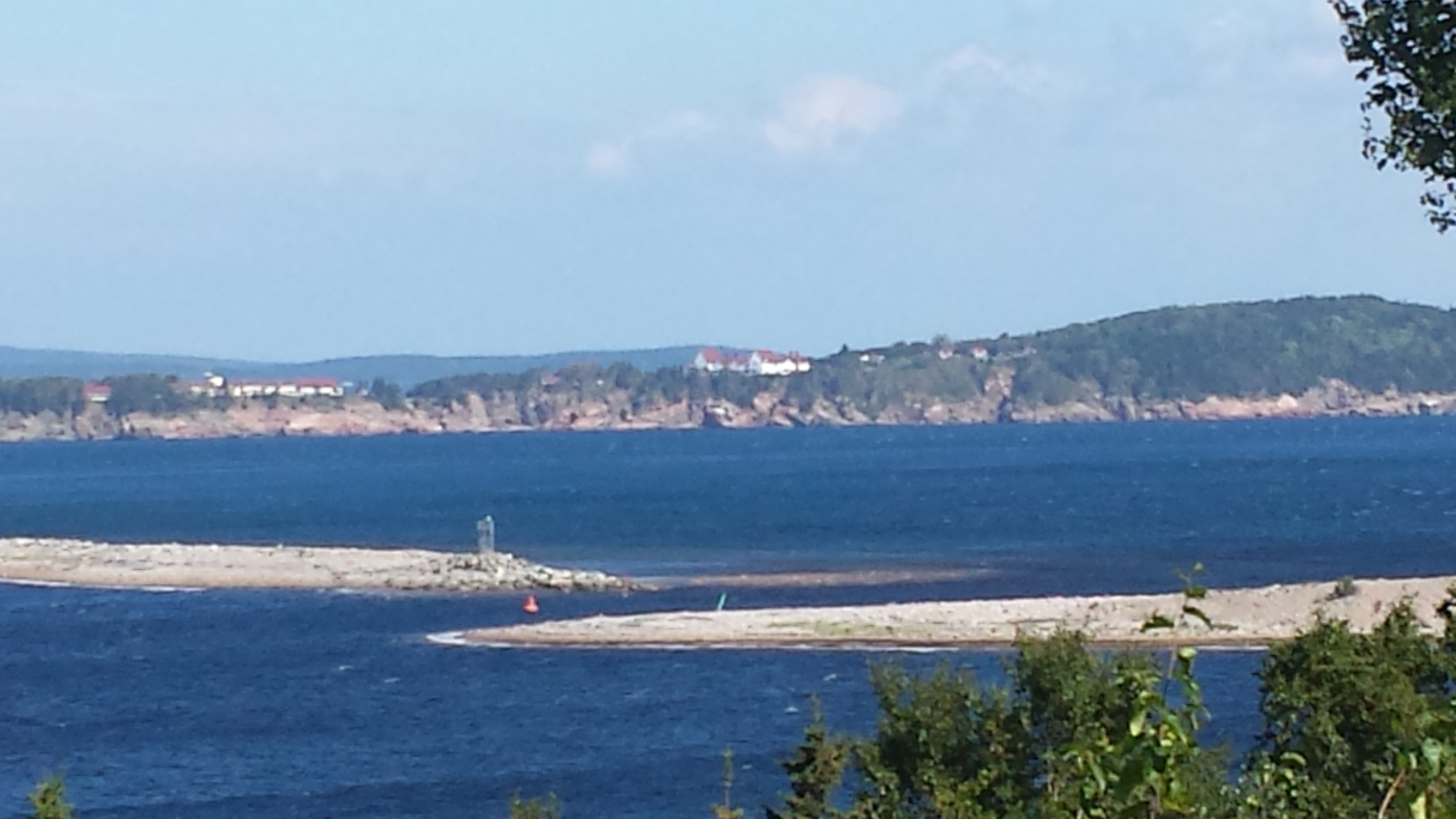
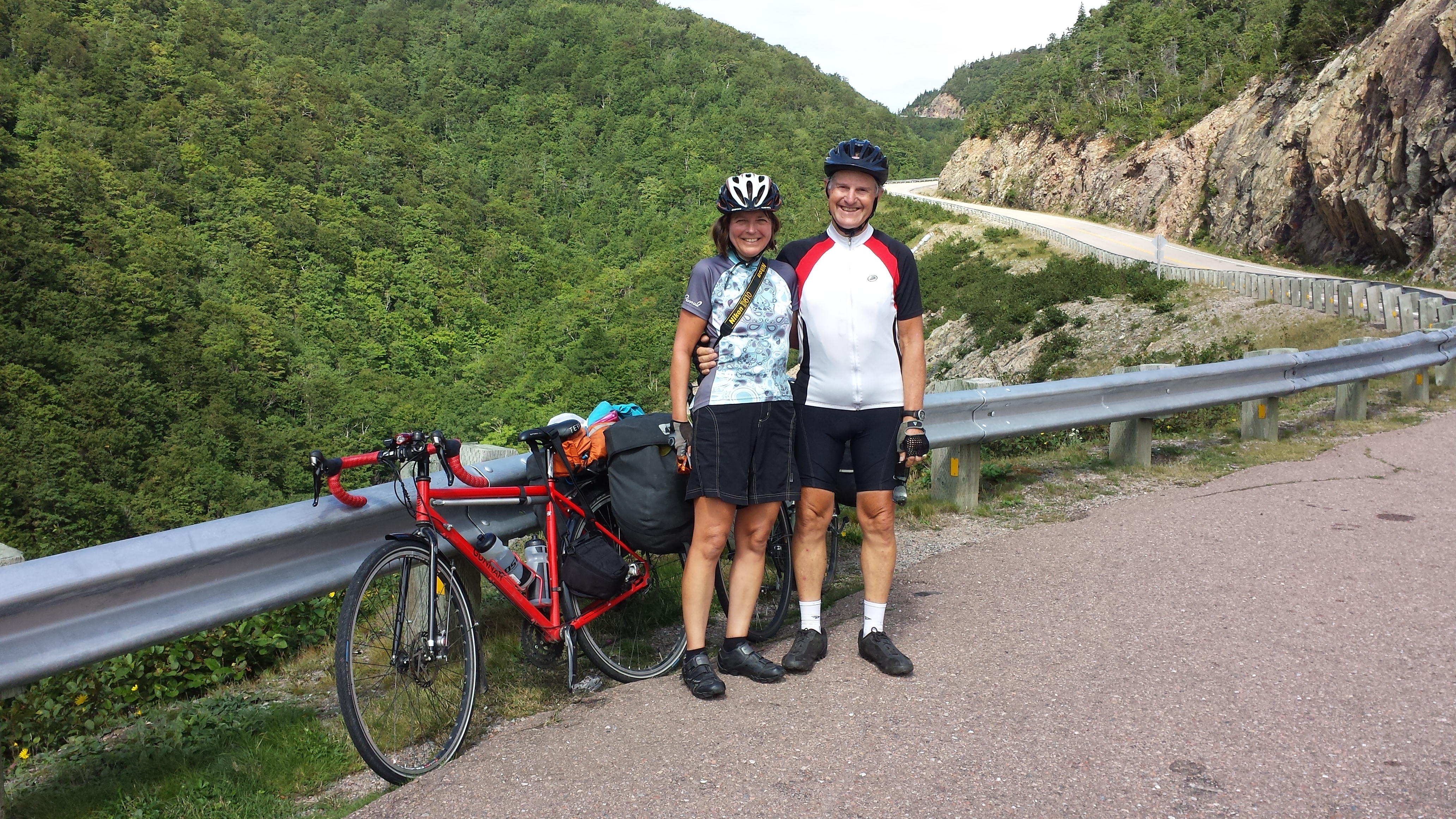
Looking back at the Cabot Trail
On the 7th, we rode to North Sydney. I was losing my preference for busy highways, after riding the Gaspe and the Cabot Trail. Interprovincial 104 was not as much fun, and the traffic stank. North Sydney was not an impressive town. Like many towns shattered by the wind-down of work in the mines and the fisheries, it was working on a very slow renaissance. Amidst the depressing neighborhoods, houses were being fixed up, new shopping centers were attracting customers, and the highway leading to the ferry terminal was being improved and expanded.
We sat on the pier near the ferry terminal, eating our lunch and watching the trucks and cars load onto the ferries. The ferry to Port-aux-Basques would sail that evening, and our plan was to be on it. Atlantic Vision was also there, due to sail to Argentia in an hour. That was the ferry that would make its last run in a week. It occurred to us to reverse our plan, catch the ferry to Argentia instead, and cross Newfoundland from East to West. We jumped on our bikes and raced to the terminal, boarding just before they closed the ramps.
Atlantic Vision is a large, ocean-going ship. There was an all you-can-eat buffet in the restaurant, so we left our own food in the panniers and chowed down. I think that the staff was more than a little amazed that we were able to put away food from all parts of the buffet in such quantities, like a plague of locusts.
That night, I considered how it felt strange to be on a ship without being paid to be there. The last time that I was a paying passenger on the Atlantic, I was nine years old. In the morning, we would make landfall in Newfoundland, a half-time-zone and a world away.

Congratulations on the new record, and just, generally, WOW!
LikeLiked by 1 person