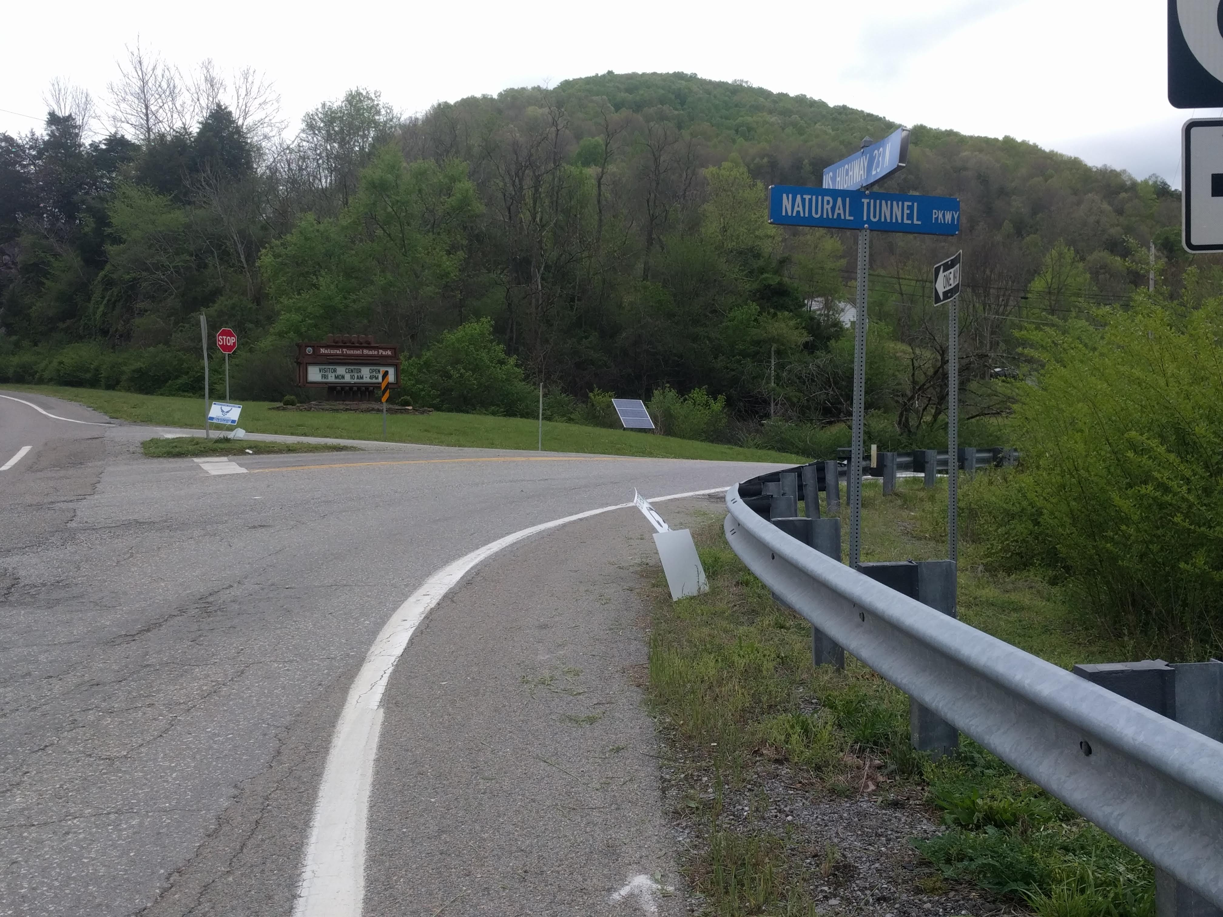
 Natural Tunnel State Park, Thursday the 6th of May. I woke at dawn and dozed until 08:30. The Duty Ranger I had spoken to on the phone showed up while I was breaking camp. Perhaps because they are so happy to be vaccinated and able to talk to people, the rangers were very sociable. He told me that I could pay at the Park Office on the way out, which was more convenient than finding the station in the Lovers’ Leap campground.
  Less than five minutes after he drove away, the electrician showed up to check the power, so obviously, the rangers had not meant for me to be powerless. The electrician was still trying to fix the power post when I pushed my bike back up to the road. Again, the sociability and friendliness of the maintenance ranger impressed me.
This park provided the first full test of the four-panel solar battery pack that I have carried. It not only recharged my phone, my lights, and the computer, but continued charging itself as long as there was light. On this trip, I would not need to worry whether there was power at a campsite or not. Internet and cell service was another story.
The forecast was for sunny skies and low temperatures. Though my tent was dry, my shoes and socks were still wet, so that I was shivering as I fixed my cold breakfast. With fresh socks in my damp shoes, I made my way downhill to US 58.
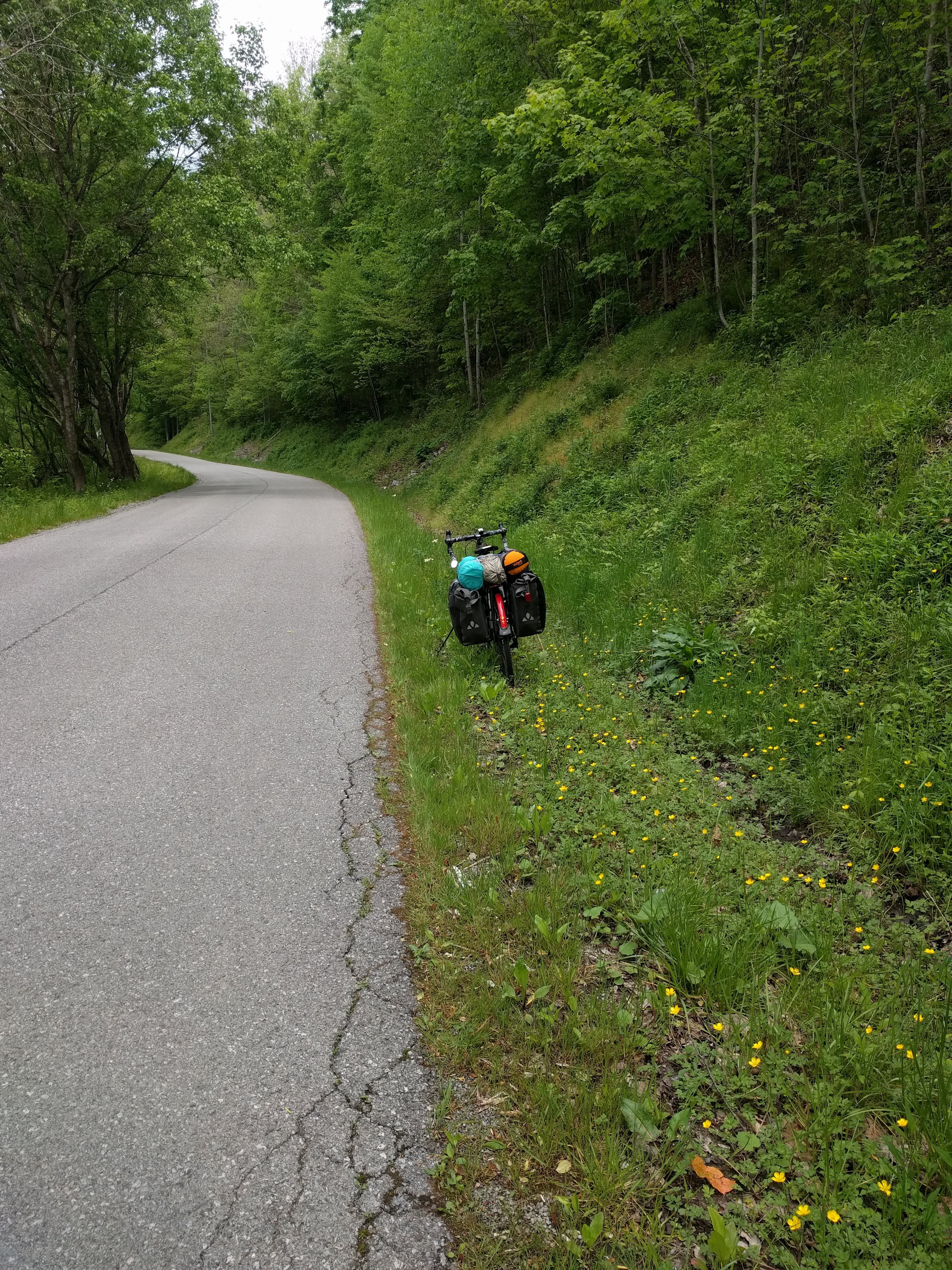
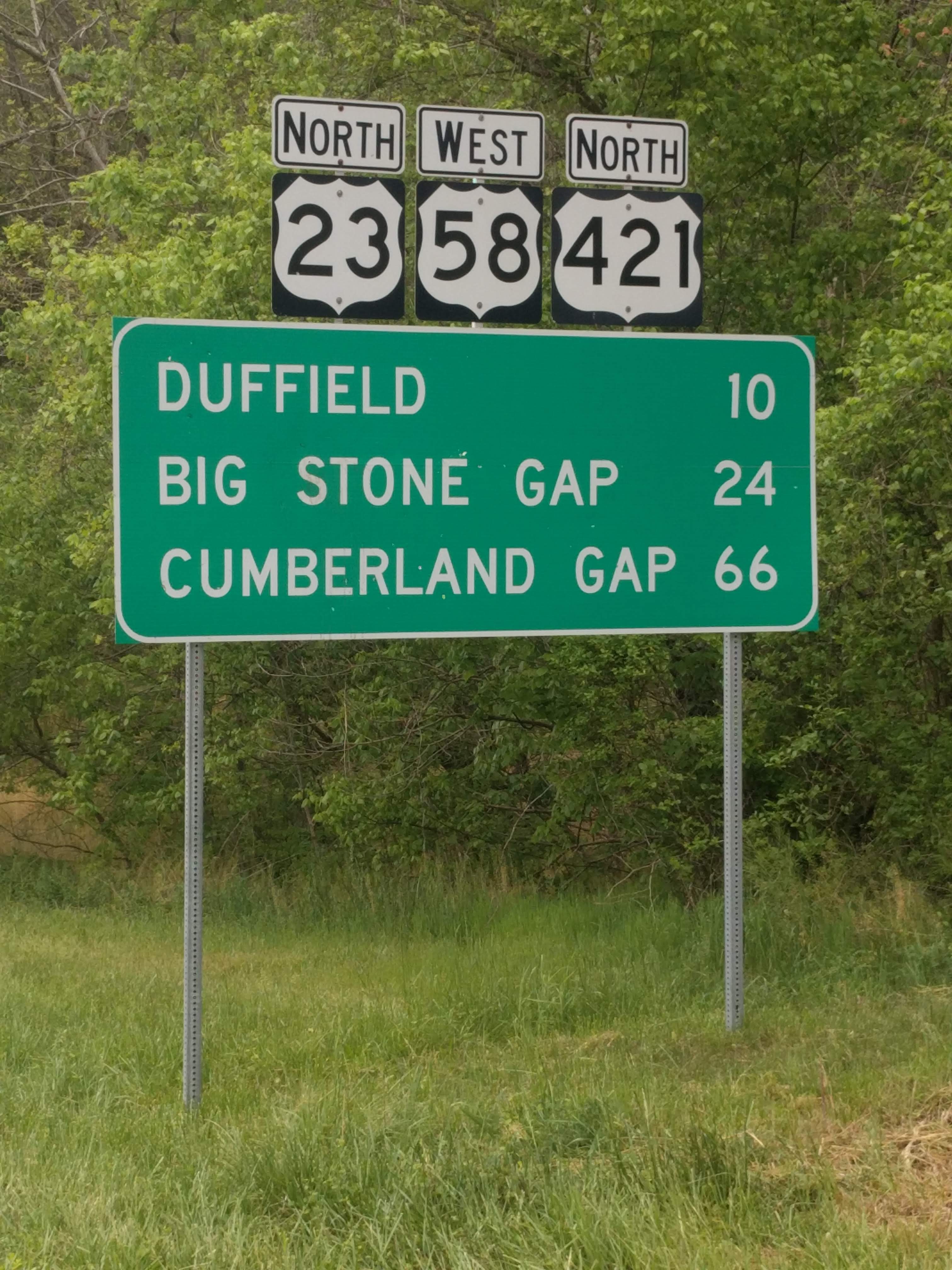 The invisible town of Duffield had a Food City supermarket, the last grocery store that I would see for two days. My Warmshowers hosts had written in the morning to invite me to supper, so I only had to pick up breakfast. Considering the terrain, I was glad of the lighter load. Leaving the parking lot of the supermarket, US-58 rose sharply up the Wallens Ridge between Duffield and Stickleyville. Though I was fresh enough to keep pedalling, the hill challenged me so seriously that I was resting at every other driveway. What looked like about two-thirds of the way up the hill, the homeowner came walking down the driveway.
A friendly, rotund chap with a Duck Dynasty ballcap and round glasses, he asked, “How are you today?”
“I’d be a lot better if this hill were just a little flatter.”
“Let me take you up in my car.”
“How much farther is it to the top?”
“Another mile and a half.”
“I’ll accept. Thanks!”
Bobby went back and got his small Toyota sedan. We packed the bike and bags into it and lashed the top of the boot down with a bungee card. On the way up, he told me that I had already ridden three miles. He also admitted that his wife had sent him out to see if I needed help, after seeing me on her way into the driveway earlier.
Chatting and enjoying the ride (we were both vaccinated), Bobby kept going. On the other side of the ridge, US-58 narrowed to one lane for a long work zone, so I was grateful for the ride. Then he turned left along VA-612 and left me halfway to the turnoff to my hosts’ home. Another beautiful intervention of kindness from strangers.
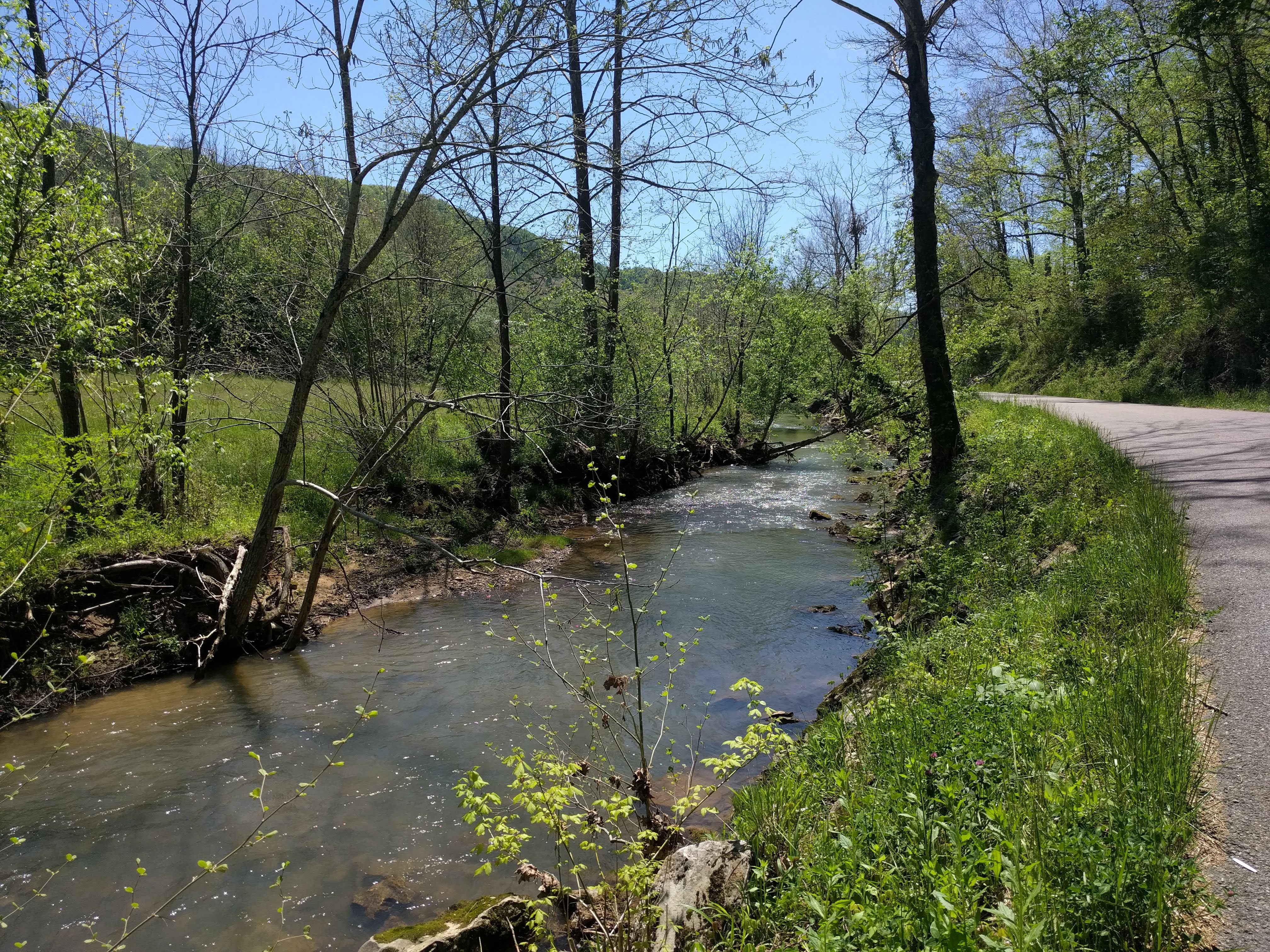
Eleven kilometres of rolling road alongside the Wallens Creek led me to the now-abandoned town of Van, at the lower end of Horse Hollow Road. My hosts lived at the Covenant Mountain Mission Bible Camp, about a mile up the road. Joe Faulkinbury surprised me by showing up with his bike-rack equipped Subaru before I even started the final hill. Thank God for that: I would have been walking all the way up!
Joe had been a racer and then a professional wrench (bike mechanic) and operated his own bike shop in Indiana before Tammy lost her job as a chemical researcher and grant writer. They had been coming to the CMMBC on mission trips from Indiana, and eventually settled in to run the camp full-time. The next camp group would be coming in June, so I had one of the camp buildings all to myself.
Dinner (baked chicken and – oh, wonder! – fresh asparagus and salad) included lively conversation about bicycles, research, and touring.
 On Friday, the 7th
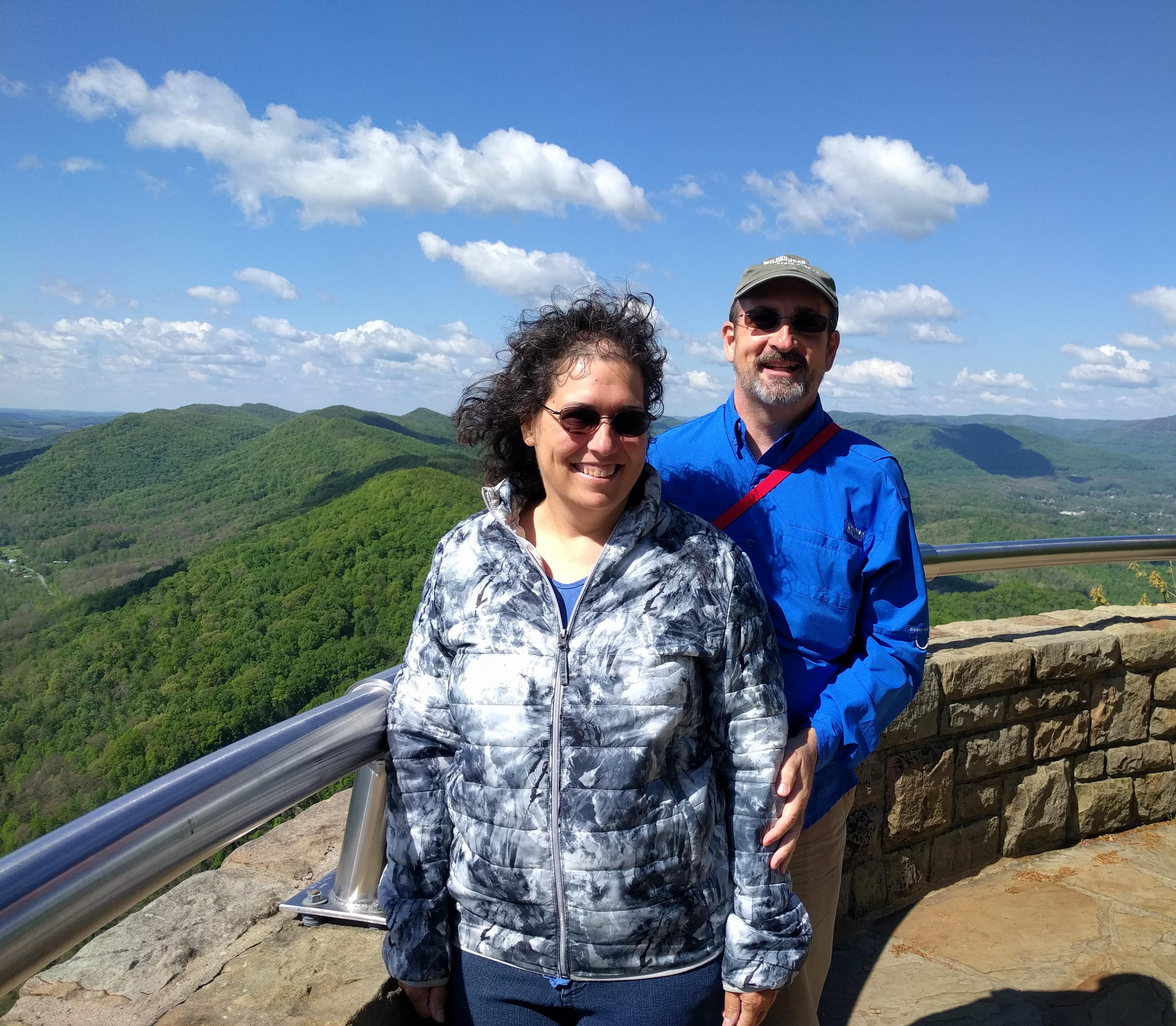
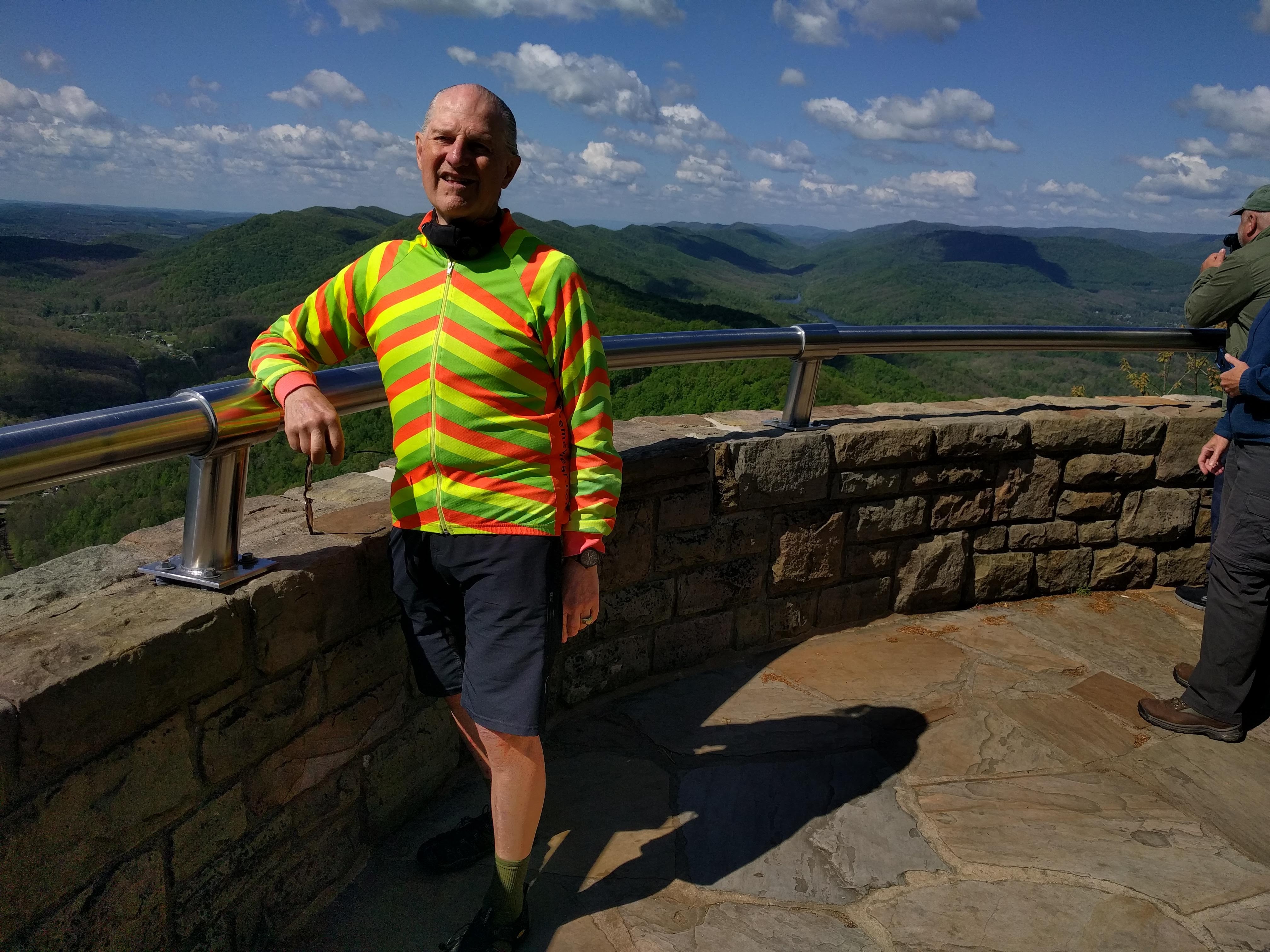
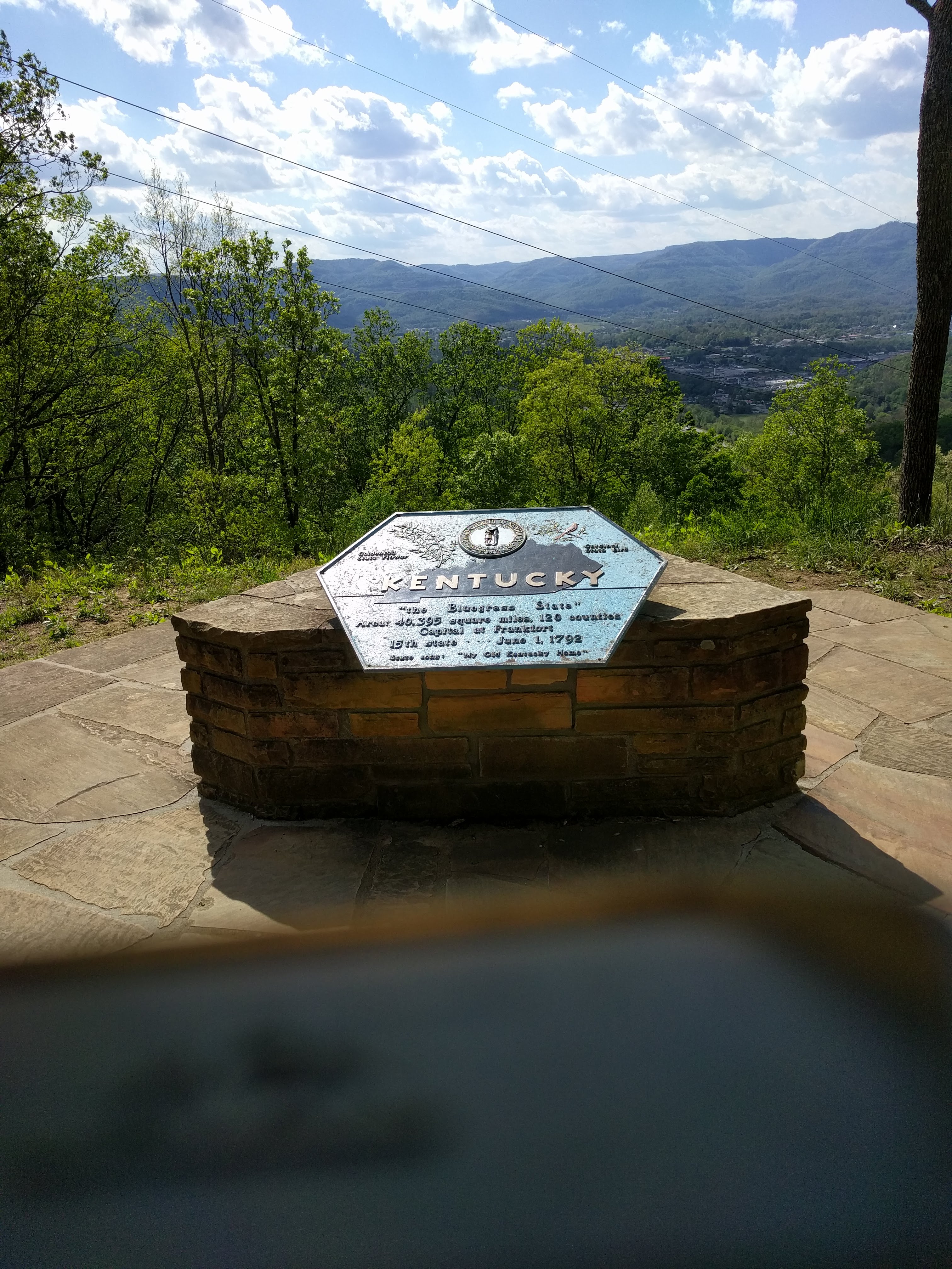
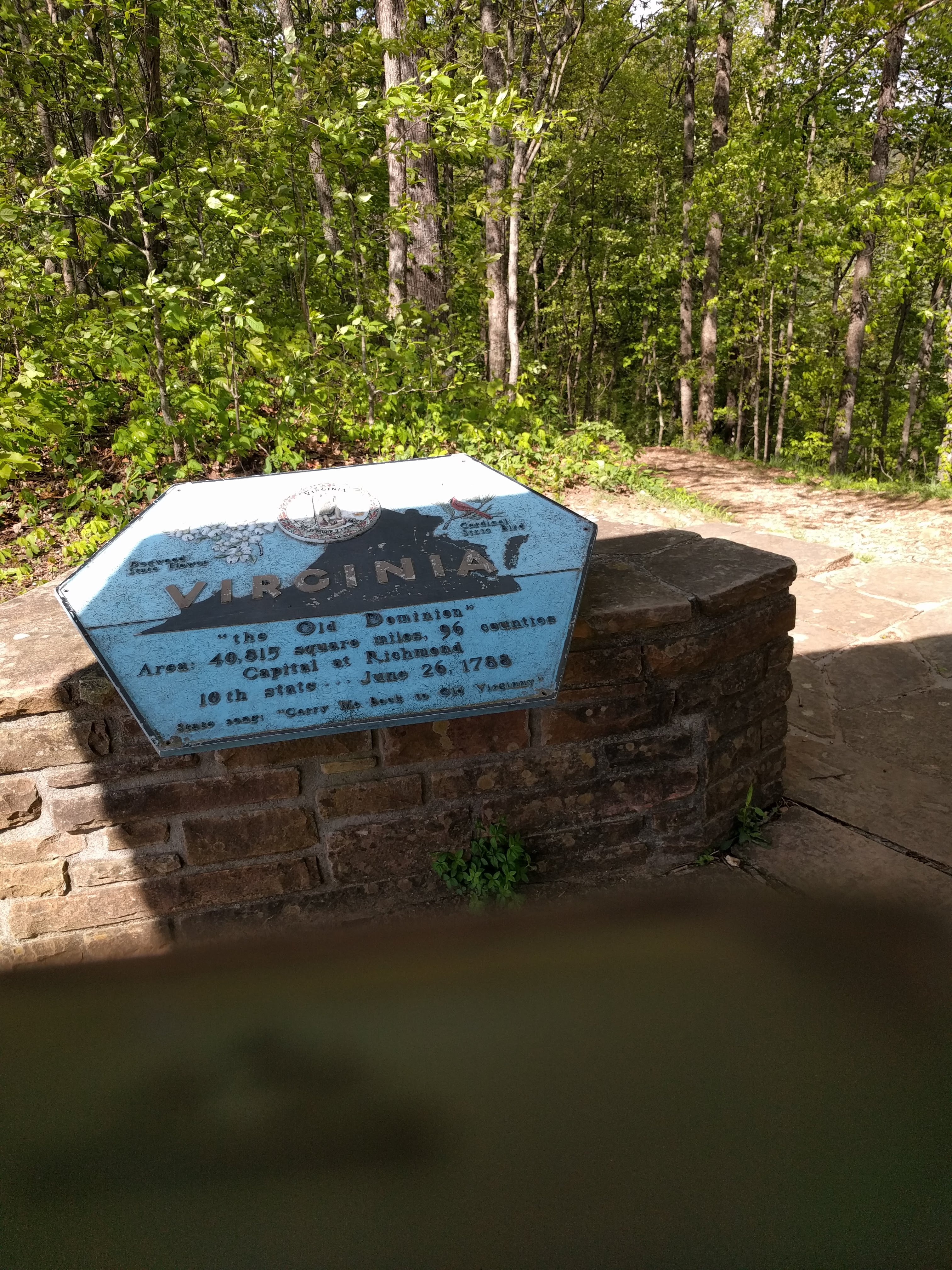
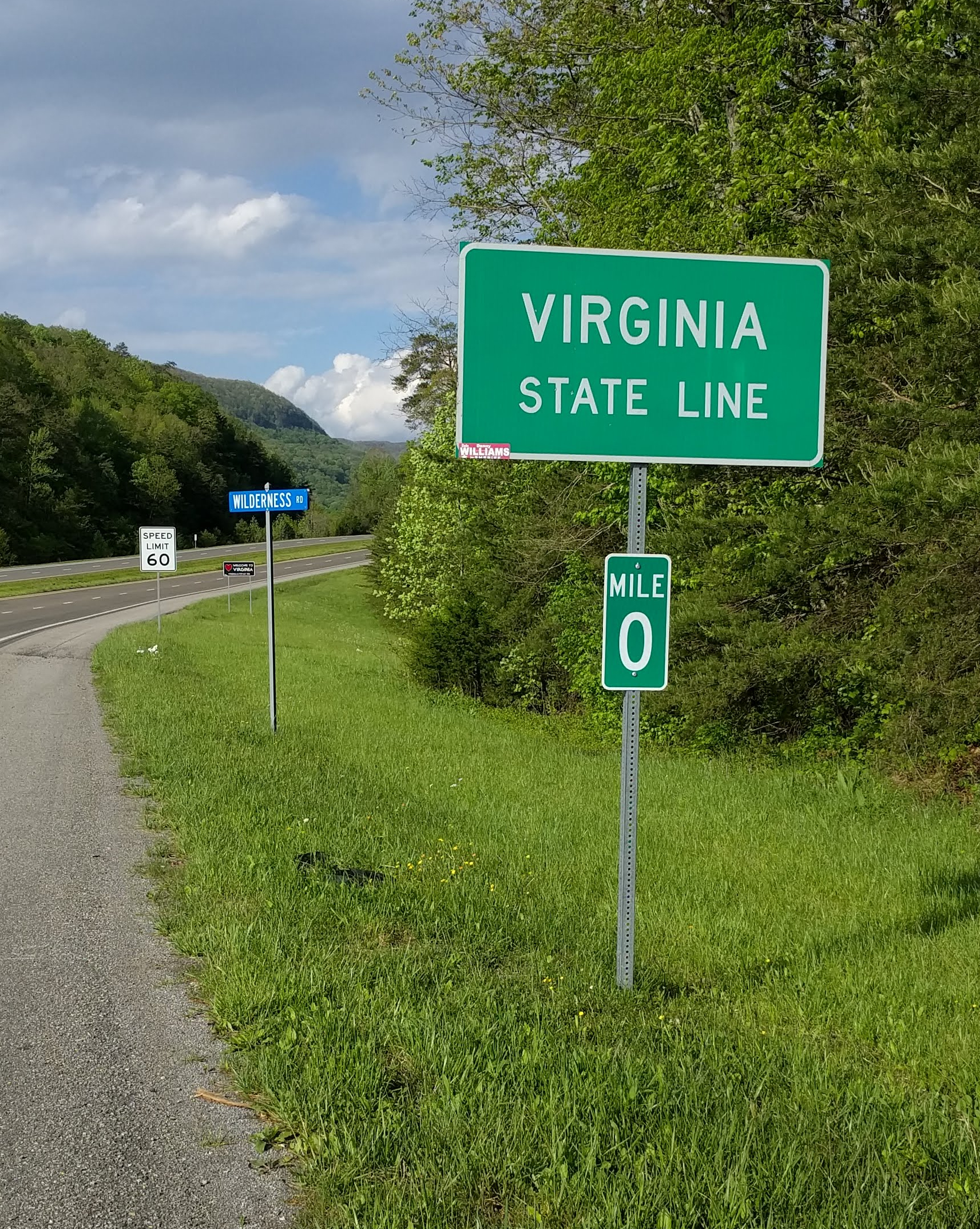
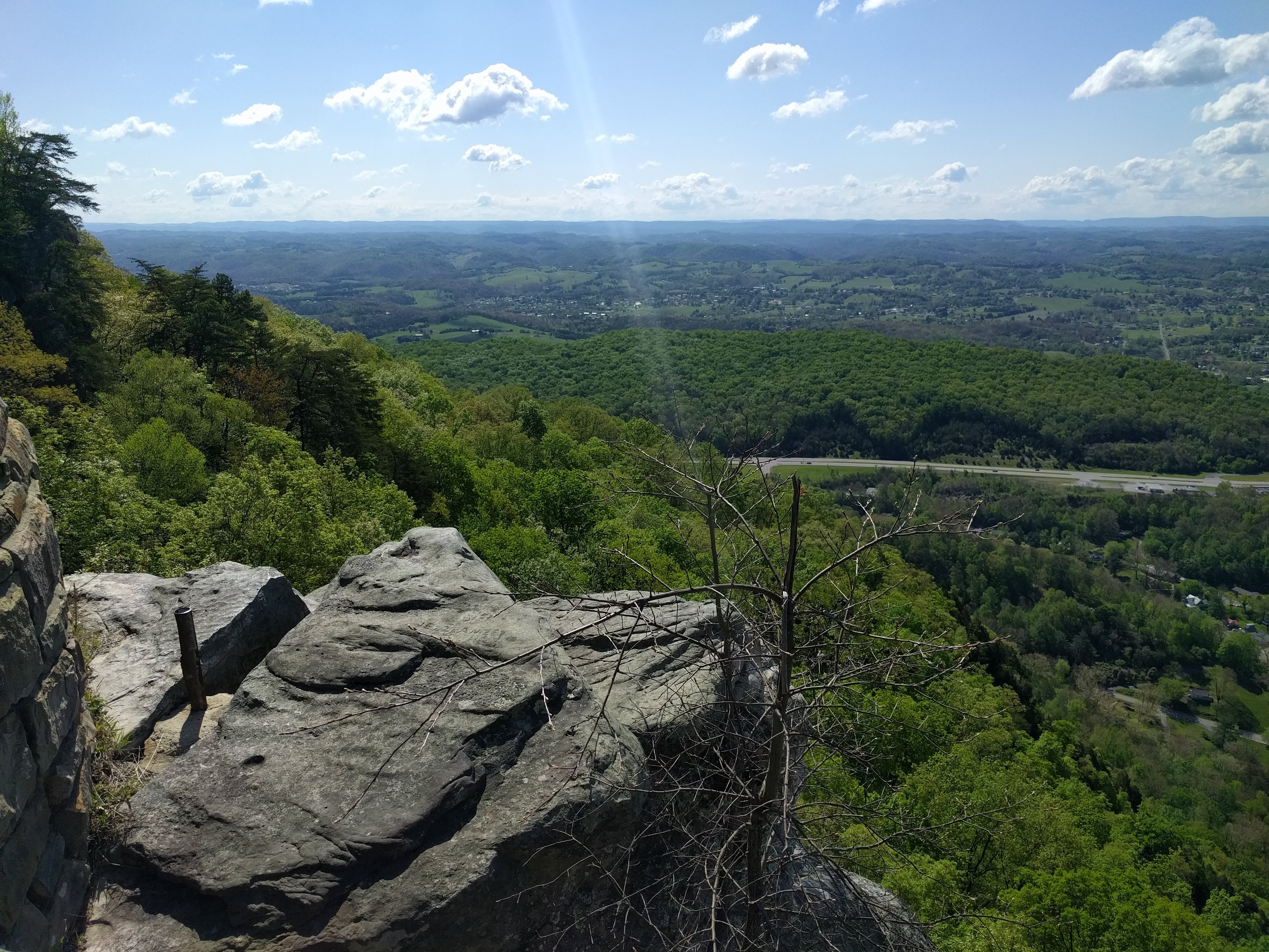 , Joe and Tammy needed to go grocery shopping, which in these parts meant driving to the Food City in Middleboro, Kentucky. They took me and my stuff along, so I could shop for the next few days in parks. On the way, they drove through the Cumberland Gap Tunnel and up to the Pinnacle Overlook with its spectacular views of Tennessee, Kentucky and the narrow point of Virginia between them. We had lunch at the Gap Creek Coffeeshop in Middleboro, then they left me at the Cumberland Gap National Historic Park Wilderness Road campground in plenty of time to set up camp, put everything in the bear box, and ride to the Daniel Boone Wilderness Road Visitor Center. On the way, I passed the Mile Zero post for US-58. I had arrived!
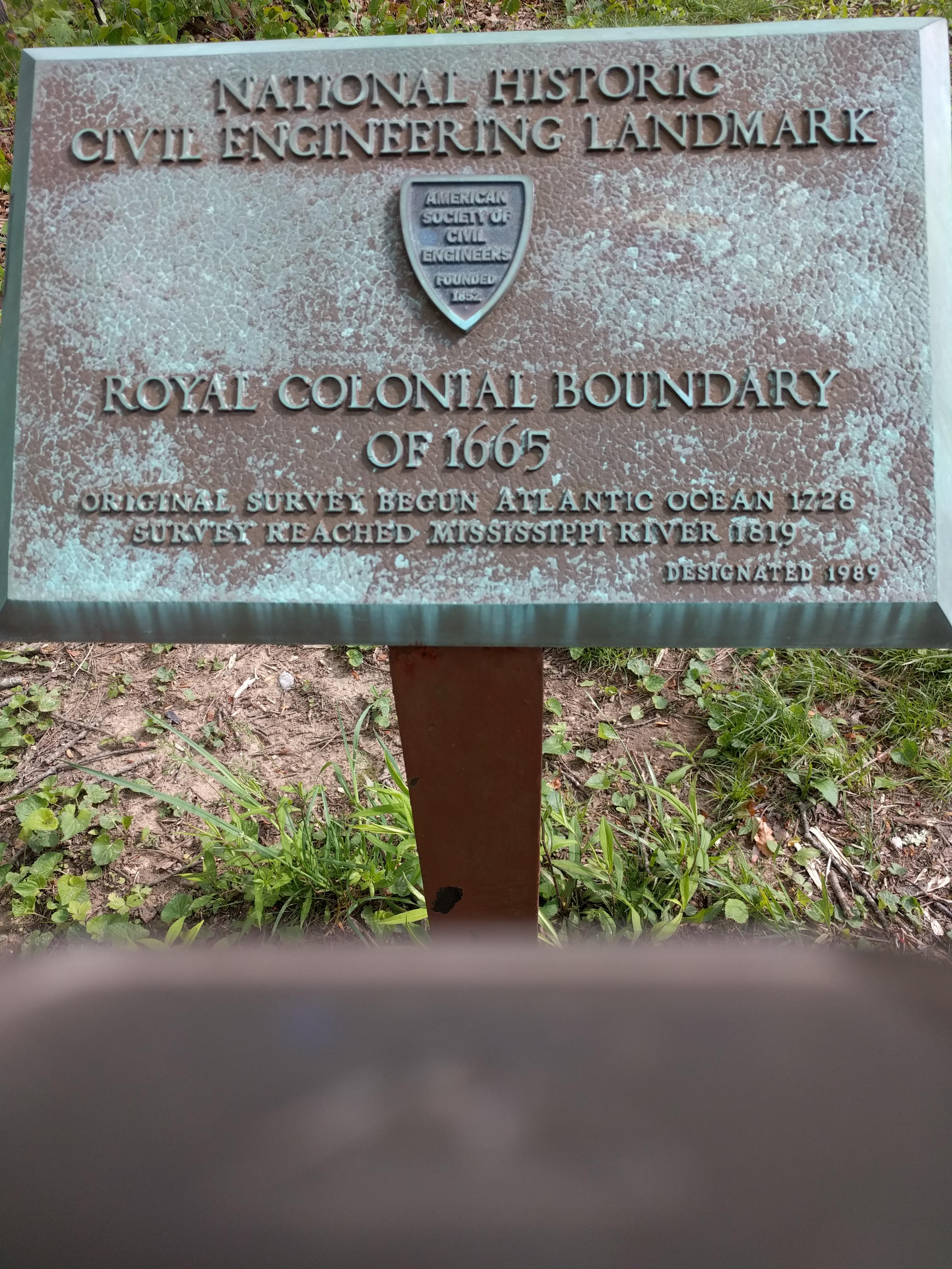
 From the visitor center, I hiked a mile and a half (3 km) to the Tri-State Marker, my objective for this ride. What I did not expect to see was the Royal Colonial Boundary marker of 1665, which was part of the Treaty Settlement Line. A Royal proclamation in 1763 forbade British colonists from settling west of that line. Those who have read the books of the Outlander series by Diana Gabaldon (after the end of the Netflix series) understand the role that the British treaty played in the escalation to the American Revolution. It was not all Stamp Act in Boston and pretty words in Virginia. When Daniel Boone led the first group of settlers through the Cumberland Gap in 1775, he defied the Royal proclamation, in advance of the outbreak of violence along the eastern seaboard.

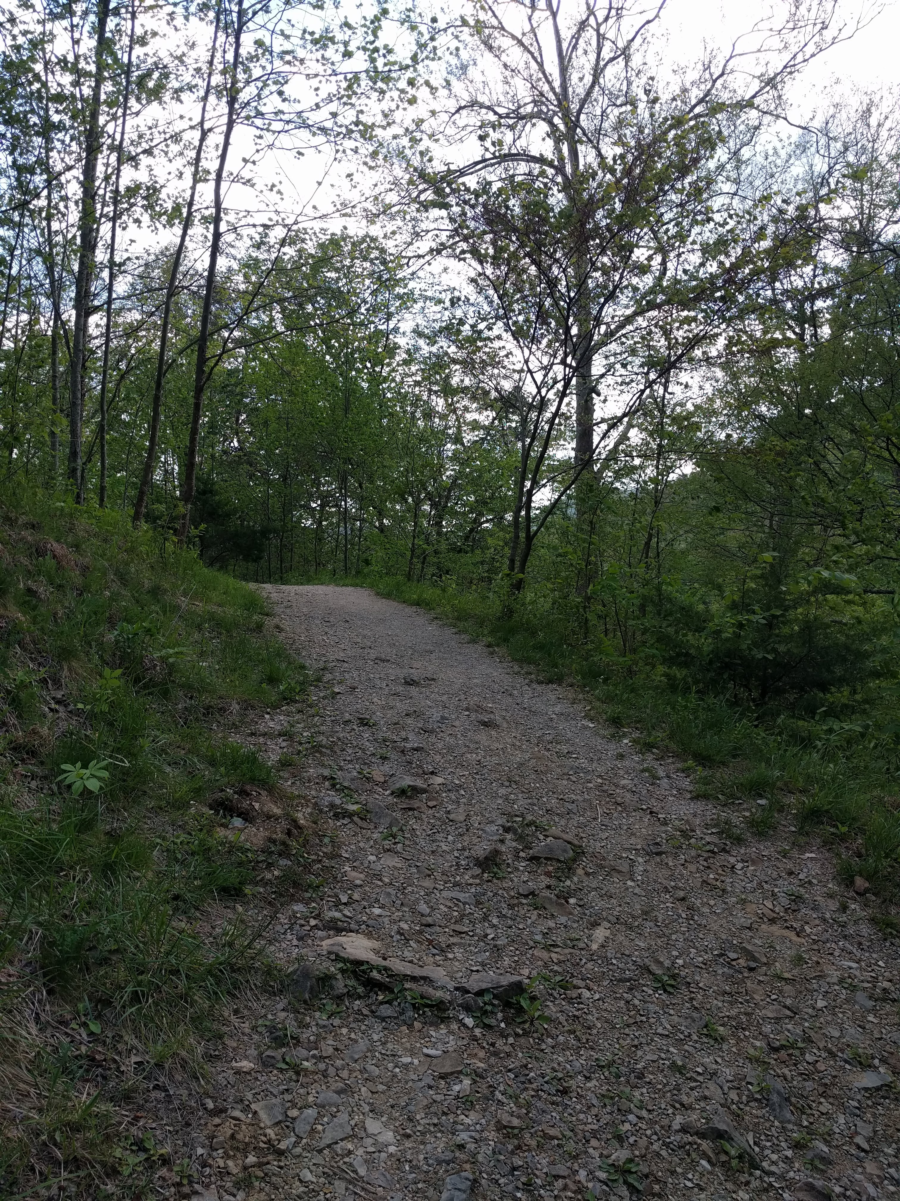
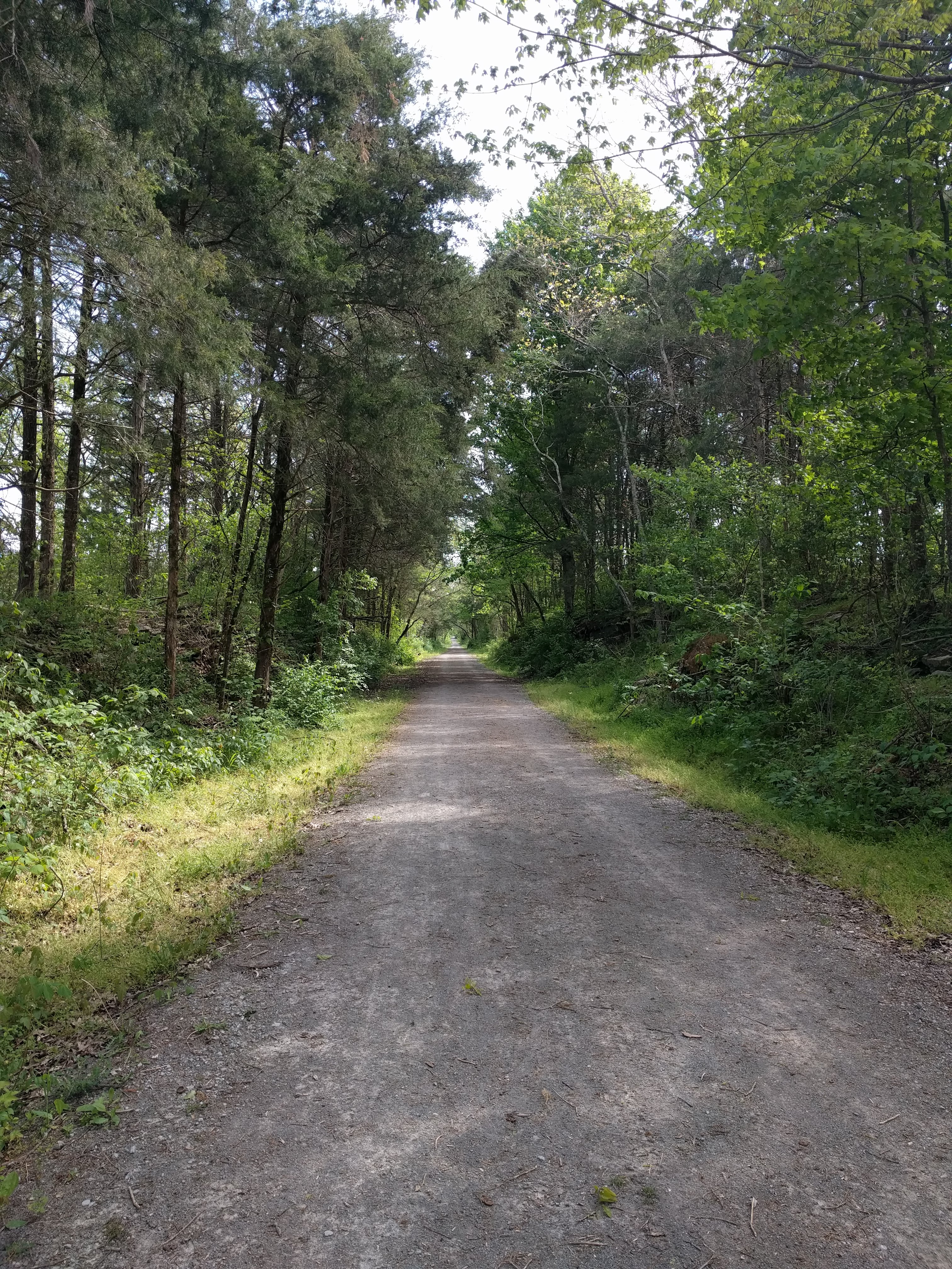
 On the way back to my campsite, I did not want to climb the long hill to the Park entrance, so I rode the Colston Trail, which started near US-58 and ran along the lower edge of the campground. Although it was a dirt single-track, without a load, I could ride it with my touring bike to a point where I saw the campsites. I pushed my bike off the trail and emerged only two sites below my own tent.
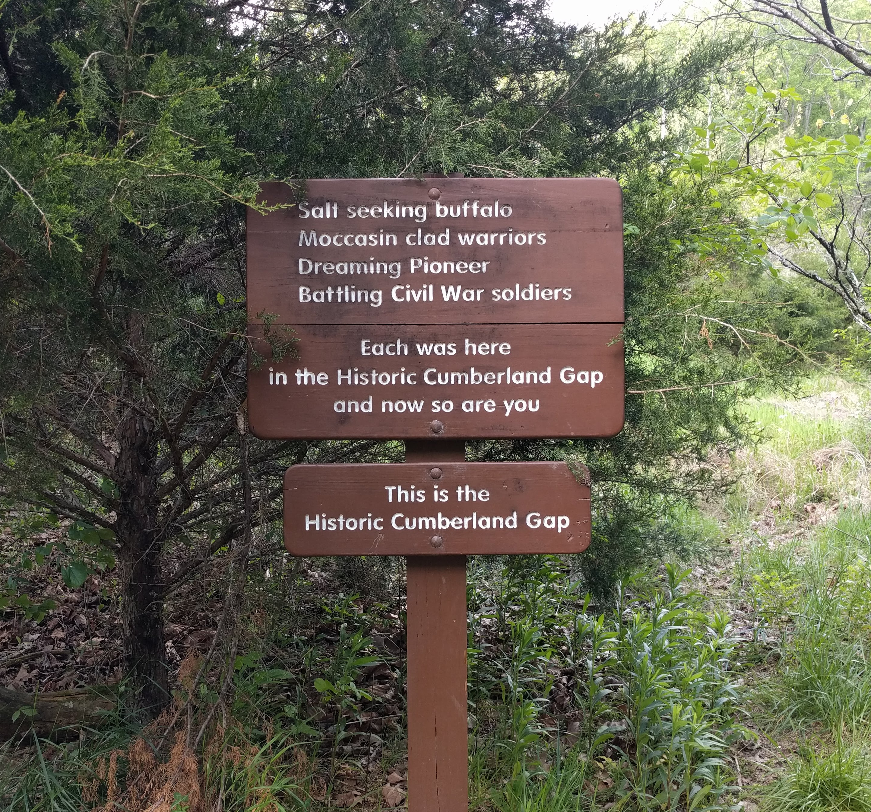
 I had ridden from one end of US-58 to the other. With a great sense of satisfaction, and gratitude for the people who had helped me when the weather or the geography threatened to discourage me, I made my dinner, and tucked into bed.
I heard rain on the tent a couple of times during the night, but in the morning, the tent was dry. I only had to let the footprint (ground cloth) dry while I made my breakfast.
 Joe had told me about the different levels of maintenance of the Colston Trail and the Wilderness Road Trail, so on Saturday morning, I rode back on US-58 to where the Virginia State Park Service maintains a trailhead for the Wilderness Road Trail. With a steady tailwind, I breezed along the well-packed gravel trail past the Wilderness Road State Park and along Hubbard Springs Road to Pennington Gap. This was the Powell River Valley, and the climbs were much gentler than those under US-58 on the other side of the ridge.
 Tammy and Joe had also told me about the campground at the municipal park in Pennington Gap, which was a bargain. Clean, quiet, flat, with a two-mile asphalt bike path along the Powell River, which led to a shopping center with a Food City, restaurants, and other retail. It also passed the local schools. I was impressed that a town that is invisible in the trees would have made the effort to build such a facility. In spite of the mountains, one does not need a motor vehicle to go to church, school, the park, town hall or shopping in Pennington Gap. On my way back to camp, I passed Joe and Tammy out for a ride on the bike path. They came by my site for some conversation before returning home.
The temperature continued to drop all day. The forecast for Sunday was sunny, but with rain at night and possibly Monday. I booked a room at the Super 8 by Wyndham in Norton, which should be a tolerable 49 km, allowing me to get in before the rain. There were no convenient campgrounds between Pennington Gap and Abingdon, where I planned to meet my friend David Truslow. Besides, I urgently needed a shower!
After chatting with Larry from Vermont in the next campsite, I was happy to crawl into my cozy tent and go to sleep.
 Sunday morning dawned sunny and not so cold. I took advantage of the town’s Wi-Fi to Zoom into the Morning Prayer service at Saint Paul’s Memorial Church in Charlottesville, where I hoped to celebrate the Ascension on Thursday in person. Then I broke camp and rode toward Norton.
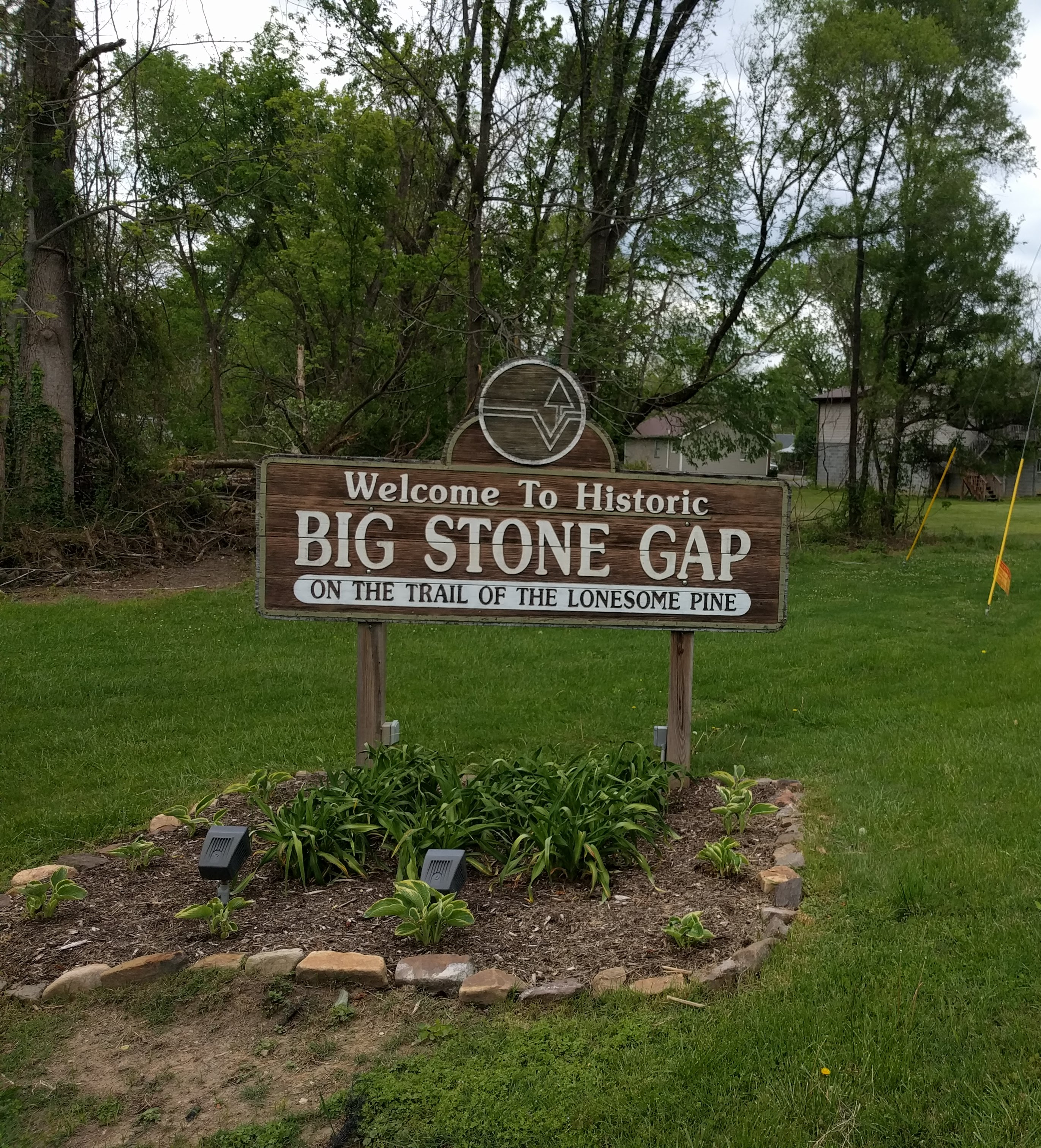
The road to Norton (more of VA 621 along the Powell River) surprised me. The hills were more challenging. On two of them I felt warning signs to back off. I did not get to be this age by ignoring messages from my body. Although I was able to ride to Big Stone Gap with no further problems, I called David. The motel in Norton cheerfully cancelled my reservation without a penalty.
 David met me in the rain in Big Stone Gap and brought me home to Waynesboro with him. I had wanted to visit with David since he moved to Waynesboro from Charlottesville years before. An idle day hanging out was a balm for the soul and restoration for the body.
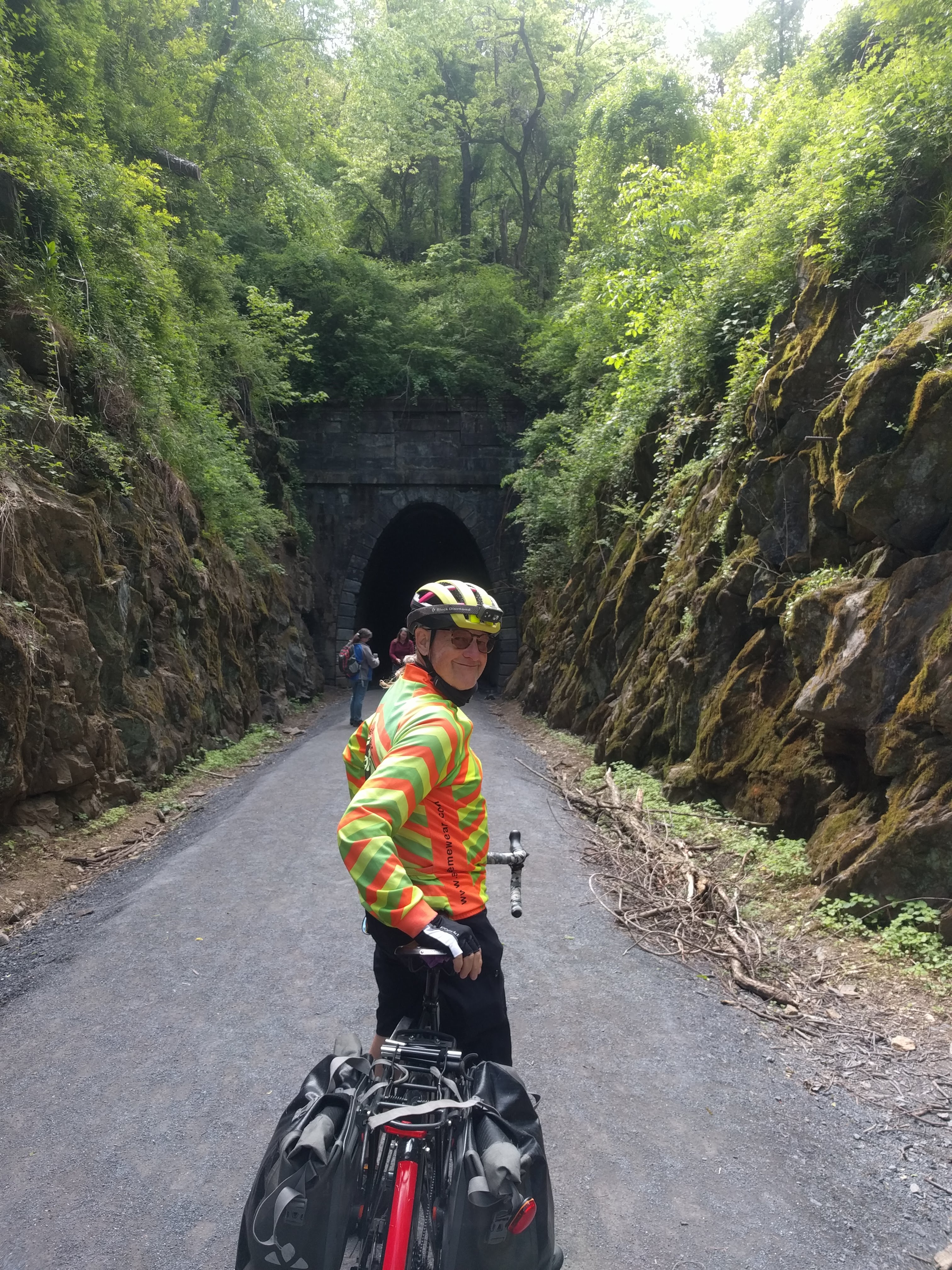 On Tuesday, the 11th of May, David left me at the western trailhead of the Blue Ridge Tunnel Trail. Although I had ridden my bicycle up the Blue Ridge twice, this was something that I had waited nine years to do: ride back under Afton Mountain. It took that long for the various non-profits and public agencies to make the Blue Ridge Tunnel Trail a reality.
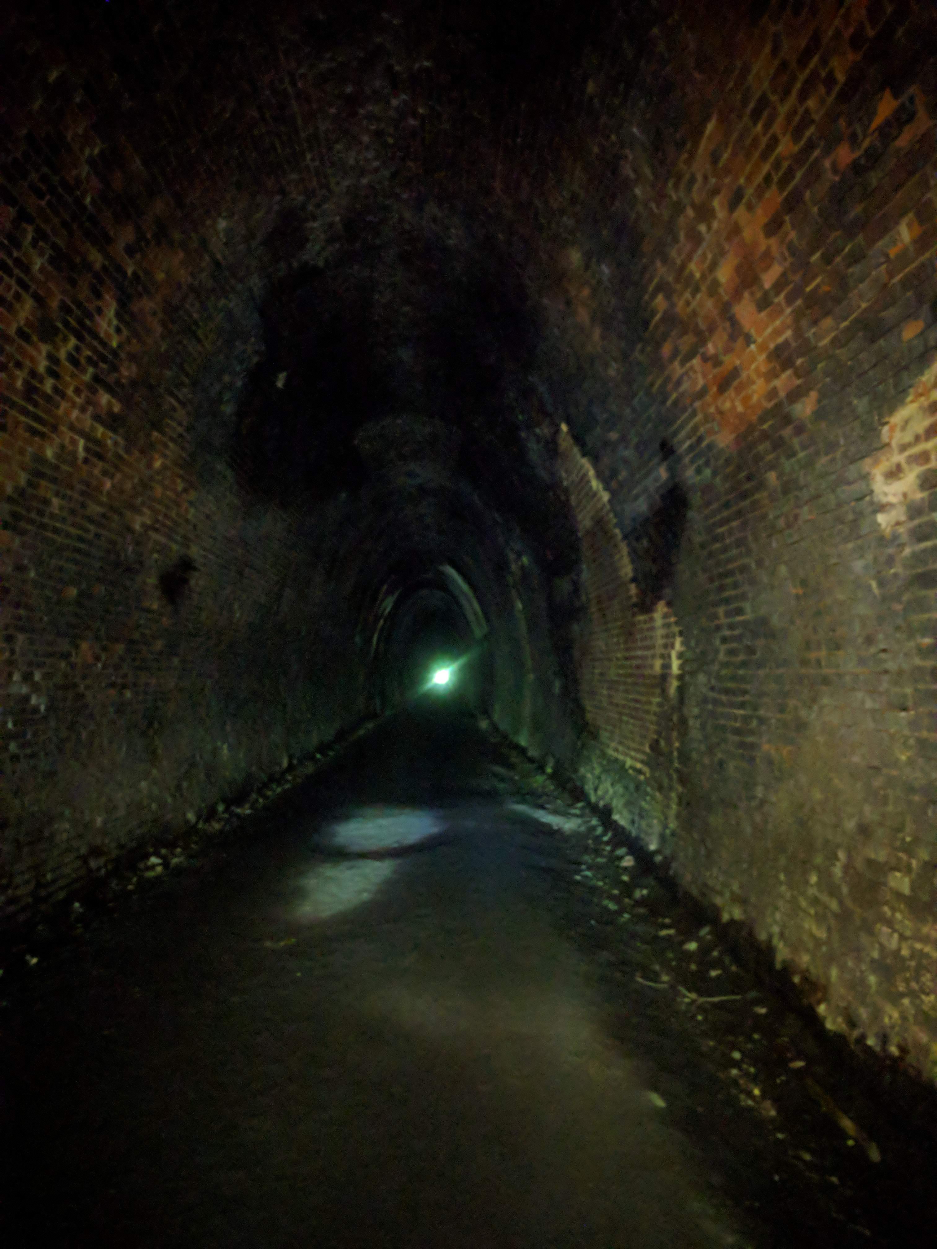
The Claudius Crozet Tunnel is named for the French engineer who was brought here in the 19th Century to build tunnels through the Blue Ridge, so that rail service could be expanded into the Shenandoah Valley. The tunnel below Rockfish Gap was built in 1850 and was the longest tunnel in the USA at the time (1,291 m, or .8 mile). The Central Virginia Railroad, later part of the C&O Railroad, ran through the tunnel until 1944, when the C&O built a new tunnel to handle the larger rolling stock.
 More details at https://en.wikipedia.org/wiki/Blue_Ridge_Tunnel.
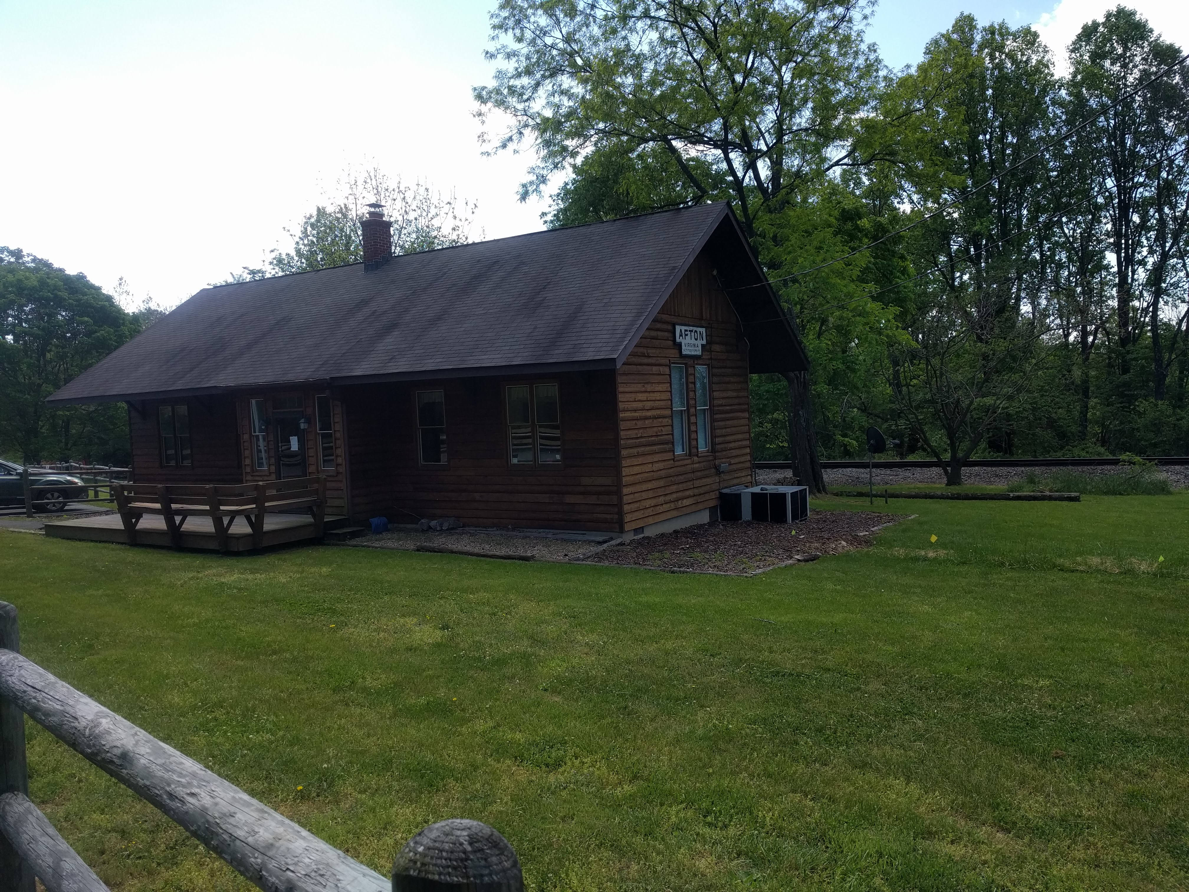 After riding and walking my bike to the top of the trail (less than a mile), I coasted through the Claudius Crozet Tunnel. The crushed limestone surface was easy on my bike, even in the soft places where water dripped from the overhead. At the eastern end, I came out at the old railroad station of Afton, Virginia (elevation 1,379 ft/420 m), sitting between the rail-trail of the old tracks and the new tracks of the CSX railroad.
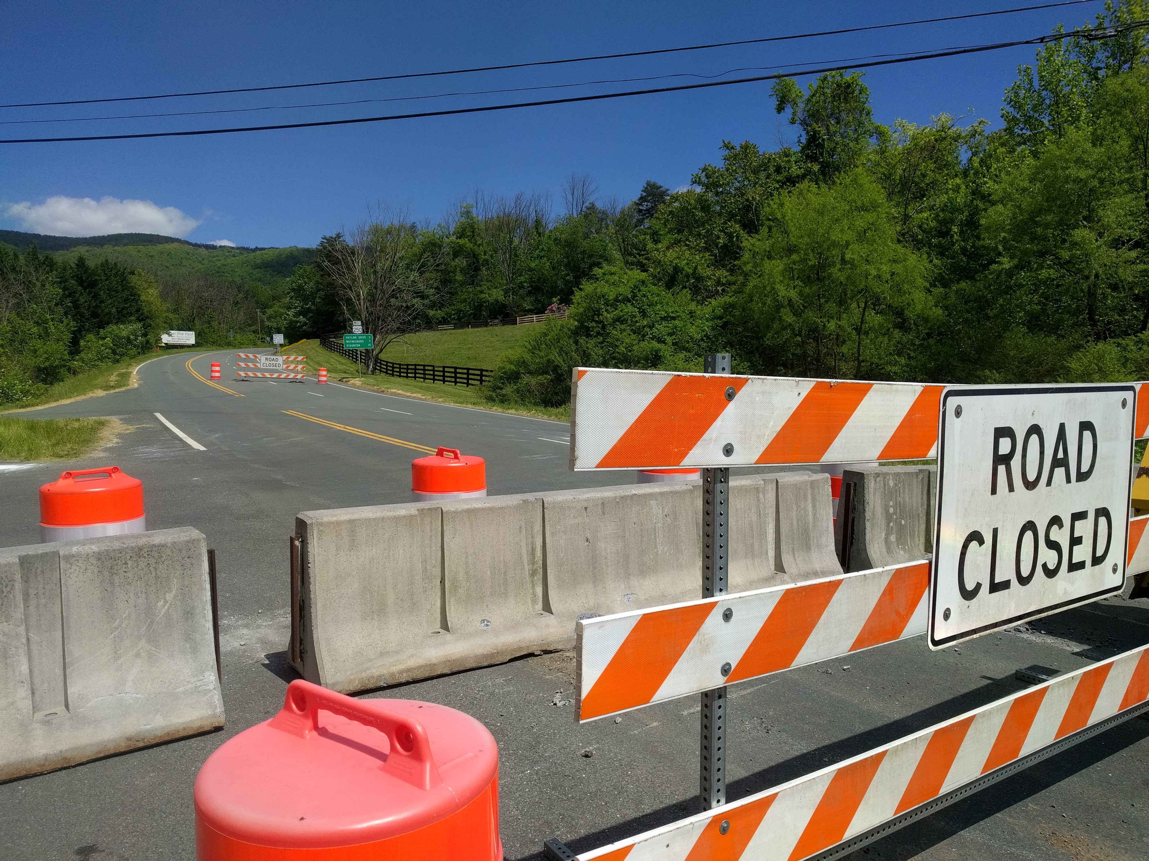 The day before, I had read in the newspapers that a large rock fall had blocked US-250 on the eastern face of the Blue Ridge. I expected it not to stop me, but I did not realize how close I would come until I emerged at the barriers on the Rockfish Gap Turnpike (US-250).
Now I was on familiar ground, my home for 31 years until last August. Charlottesville sits a few hundred feet lower than Afton, so by lunch time, I was letting myself into my son’s apartment. I was home with family. Everything ahead would be local riding to Norfolk, which I had done before, and reported on in other blog posts (the blog categories Southern Swing 2013 and Northern Trek 2014, as well as the book Emily & Hilda). This tour of Southern Virginia was complete.
There was one new thing to do. On Saturday, the 15th of May, I left Sandston, east of Richmond, and rode the Capital Trail to Williamsburg. I had ridden the portions of the Trail near Richmond and Jamestown, but today I rode the part in between.
The Capital Trail has been hailed as a fine example of what a bicycle trail could be, but I was not prepared for its excellence. Few trails in North America meet my standard for bicycle facilities, but the Capital Trail:
- Goes somewhere. It connects two important destinations, Richmond and Jamestown/Williamsburg, and from there, the ferry to South Hampton Roads.
- Is paved. The asphalt finish on its entire length allows through-riders like me to speed along at highway speeds, courteously avoiding pedestrians and other cyclists without slowing down. This was the longest day in the saddle since I left Norfolk: 101 km, which I covered in 5.5 hours!
- Is gentle. No long, grinding climbs, only a few tree roots, great sight lines.
- Is separated from the road. As a “vehicular cyclist”, this is not so important to me, but it means a lot to others. Only about six blocks total shared the pavement with a back road to get between sections of the trail.
- Connects with interesting stops. Winding through Charles City County and James City County, the Trail passes restaurants and most of the destination plantations of Tidewater Virginia.
Along the way, I had lunch at Cul’s Courthouse Grill in Charles City, then walked across the Trail to a refreshment stand set up for a group of cyclists on rides of various lengths. The Richmond Chapter by Black Girls Do Ride! sponsored and supported the rides. I remembered when they had been first established in 2013, and I was pleased to see a dozen of their riders stretching at the trailhead when I started the Trail. The (s)hero of the group was at the table, and she told me that they now had 600 members in Richmond, a like number in Hampton, and some 25,000 members in chapters all over the country. I was stunned and delighted, because I had hoped very much for the initiative to be a success.
I checked into the Super 8 by Wyndham in the Historic District of Williamsburg in plenty of time to shower and change for dinner with my friend Dulcy and her friend Ilene. A delightful end to a delightful day.
Sunday dawned sunny and cool, so I rode down US-60 to the Newport News Transfer Center to catch the number 961 bus under the Elizabeth River to Norfolk. By mid-afternoon, I had parked my bike in my flat and logged the last 46 km of my month-long ride. After supper with Nellwyn and Richard, who had car-sat while I was away, I unpacked at home and put my feet up. Preparing for the next tour could wait until Monday.
So, now that I am back, what have I learned?
This trip showed me a part of my native state about which I had only read. The signs of four hundred years of European expansion across the colony and through the Cumberland Gap were evident in each little town I rode through. The resilience of the settlers and farmers was also evident in the history of adapting to changes in the global markets for their crops and products: tobacco, cotton, furniture, textiles, peanuts, coal, uranium – all have had their heyday.
On the other hand, most locals don’t or won’t recognize some of the darker aspects of the story. While other parts of Virginia are clamoring to bring down monuments to the Lost Cause, most of US-58 is named for ardent segregationist A.L. Philpott, and other sections are named for J.E.B. Stuart. In some places, if it weren’t for the post offices, there would be more Confederate flags waving than American ones.
The many prisons that I passed reminded me of the peonage system and the Black Codes. And there is literally no sign left of the people who lived there before the Europeans arrived. I hate to think how my trip would have unfolded had I not had fair skin.
So, for me, Southside and Southwest Virginia along US-58 was “crazy, mixed-up charm.” I would never recommend it as a bicycle touring excursion. It satisfied a deeply personal curiosity, but I would never repeat the ride.
Breaking Out 2021 should continue in June, with a ride on US-89, the National Parks Highway, and arguably the most scenic road in North America. I hope to meet my friend and mentor, Cheryl, at Glacier National Park, and ride south to Flagstaff, Arizona. We’ll take the Southwest Chief to Chicago, then ride the Great Lakes and the Erie Canal to New England. There may be a break in this blog, because the summer tour with Cheryl is also my summer vacation. But I’ll be taking notes.
First, an annual physical exam. I want a clean bill of health from my medical team. Stay tuned.
Meanwhile, I will resume the story of River Run 2017, which we left as I was about to ride from Bratislava in the Czech Republic to Eisenstadt in Austria. That will resume in two weeks. Next week, a sea story from my Navy days, if I don’t write another short story first. Come back to my author blog and find out!
 Your comments and questions help me stay engaged. Feel free to post remarks or questions in the comments below.
Smooth roads and tailwinds,
JT

I notice you refer to yourself as a ‘vehicular cyclist’. That’s what I was, too, for many years, but the older I get, the less comfortable I feel about sharing the road with motor vehicles. So now I agree with all five points in your list of your standards for bicycle facilities, including # 4.
LikeLiked by 1 person
Dear Nemorino, even at our age, I would still prefer a four-lane (two in each direction) with a generous shoulder to a poorly paved, ill-maintained cycle track with tree roots. The Sea-to-Sea (Atlantic to Mediterranean) route in SW France is an example of the latter, a stark contrast to the piste cyclable from Lacanau to Bordeaux or the Radsweg along the Danube. Still, riding in peace and quiet is a salve for the soul. Thank you for sharing your thoughts. SR&TW.
LikeLiked by 1 person
By coincidence, I’ve just been reading a series of blog posts by a young couple who have just cycled that Atlantic to Mediterranean route from Bordeaux to Sète, arriving just in time for the reopening of the cafés and restaurants after the latest Covid shutdown. They encountered some excellent cycling trails and some awful ones, and everything in between. Their posts begin here: https://wattleandmimosa.wordpress.com/2021/05/04/day-one-bordeaux-to-saint-laurent-du-plan/ .
LikeLiked by 1 person
Thank you for sharing this link. I hope the other readers enjoy it, too. I agree with the assessment: the best and the worst. Particularly nice close to Bordeaux. SR&TW.
LikeLiked by 1 person
So glad you made this trip, Jonathan! Thanks for “taking me along!”
~~Peace, V
LikeLiked by 1 person
You’re welcome. It’s good to be back.
LikeLike
Pingback: Breaking Out 2021: the Cumberland Gap — The Freewheeling Freelancer | Ups Downs Family History