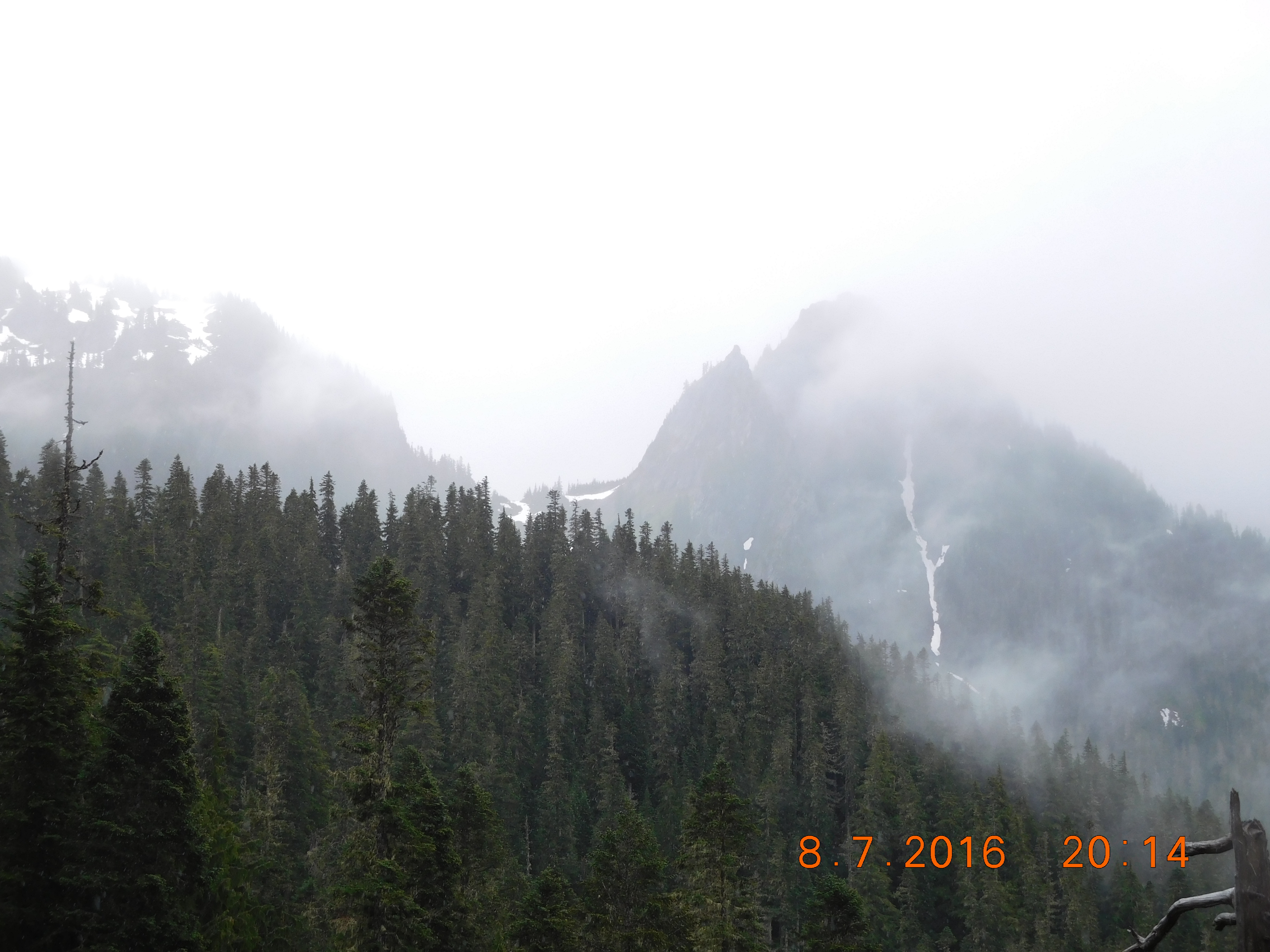
 Thursday the 7th of July, the weather over Mt. Ranier National Park cleared overnight, so Friday when we left the Paradise Lodge, we could take some pictures. The clouds persisted on the peaks, which was normal. We followed Forest Service roads through the Gifford-Pinchot National Forest, stopping occasionally to admire an especially striking view.
 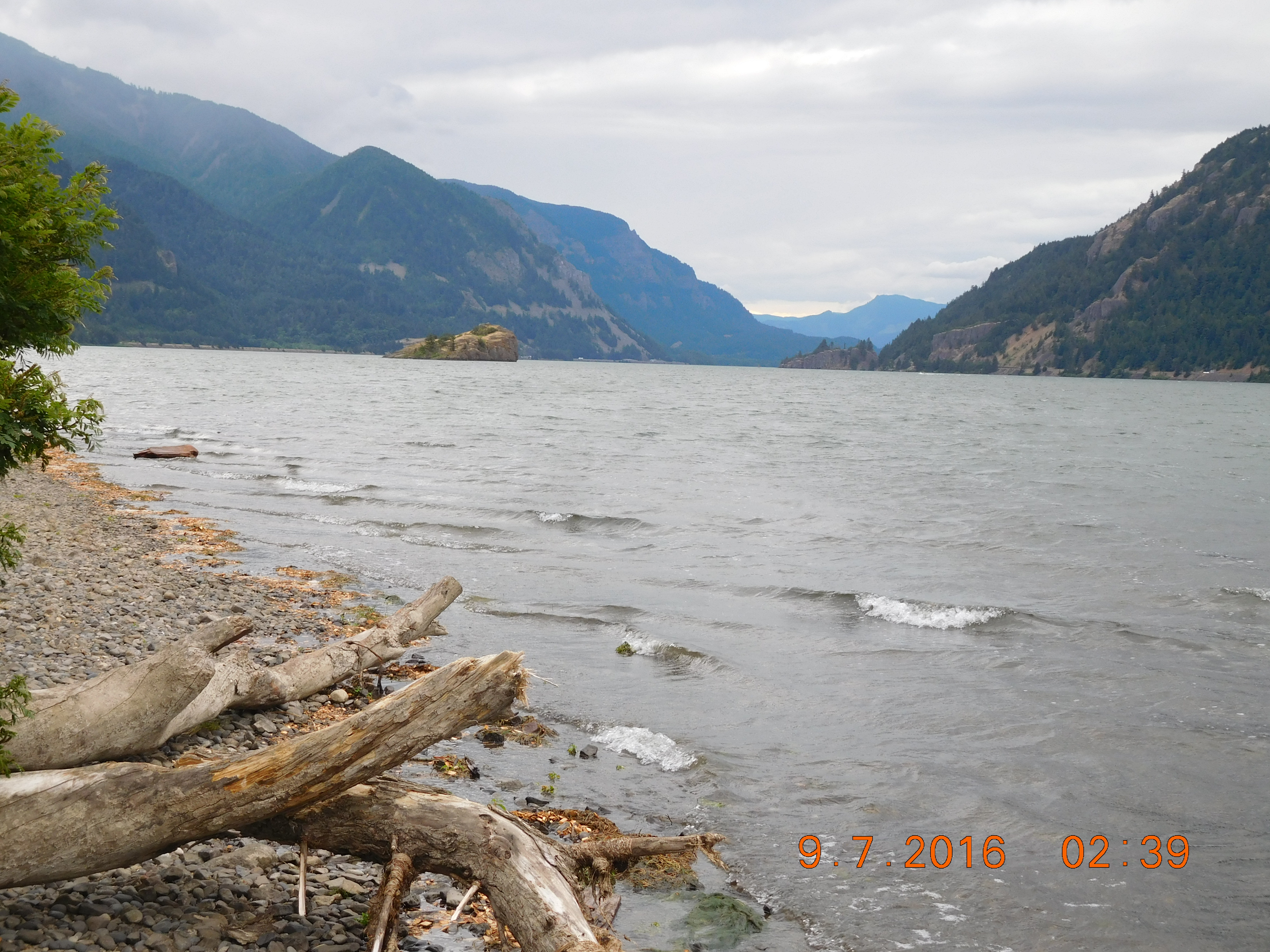 Hood River in what is called the Gorge of the Columbia River turned out to be a pleasant and attractive town, the center of wine production, adventure rafting, and fruit growing in the region. We pitched our camp in Wygant State Park, between Hood River and Cascade Locks. Although a well-equipped facility, the camp suffered from a terrible location between I-84 and the railroad. This may account for the bargain price for a campsite. We drove into Hood River to check out the town, and chose a relatively new gourmet restaurant (Celilo) for supper. Sleep was interrupted several times each hour by the horns on the freight trains rolling between the campground and the river.
 On Saturday the 8th, we followed what the Hood River tourist board calls the “Fruit Loop”, down State Route 35 south through the orchards and vineyards of the Columbia Basin.
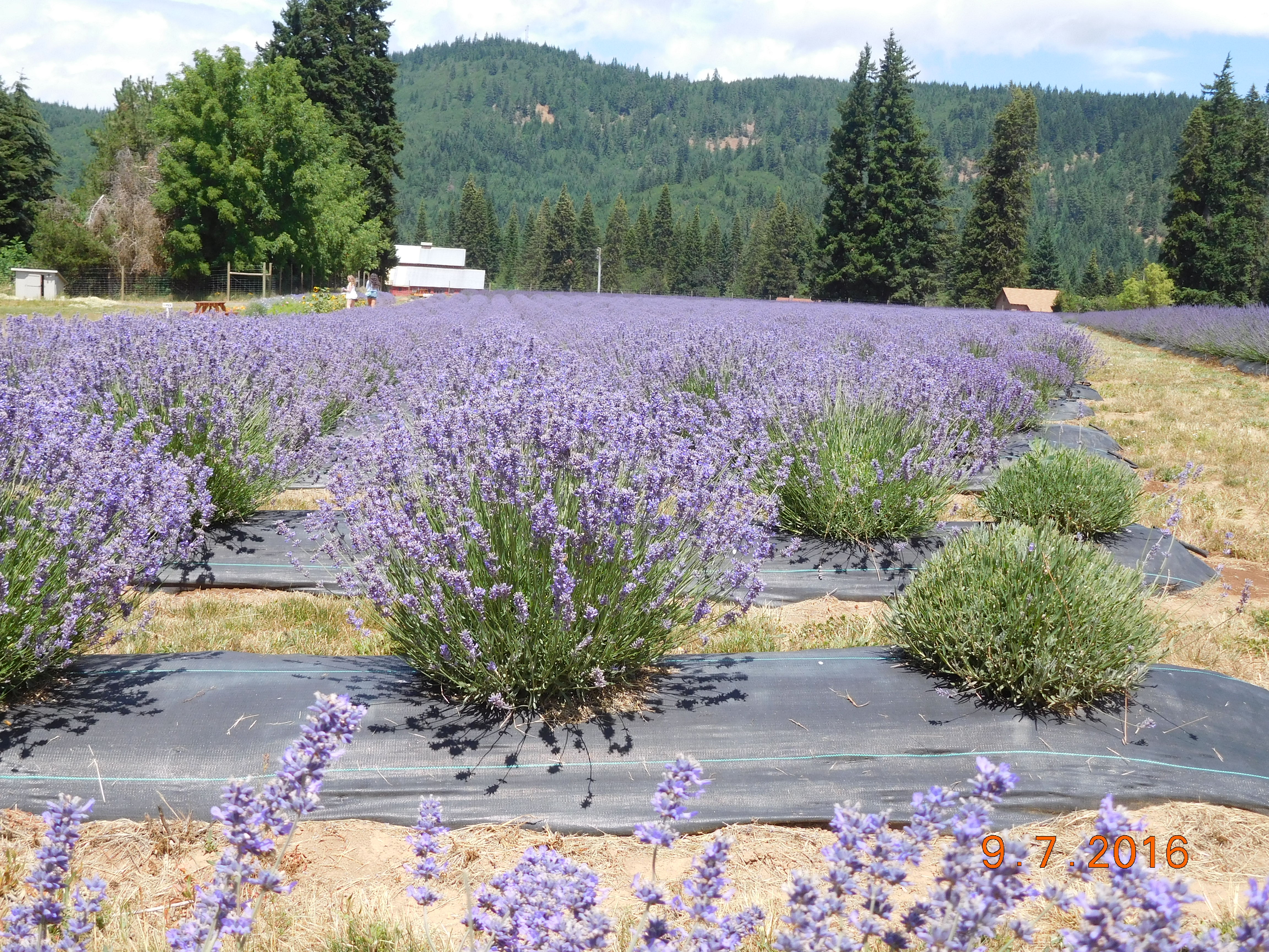 We stopped at the White House in the Gorge, a beautiful home and U-pick farm, and Lavender Valley, where millions of happy bees left us alone as they gorged on the fields of purple flowers.
 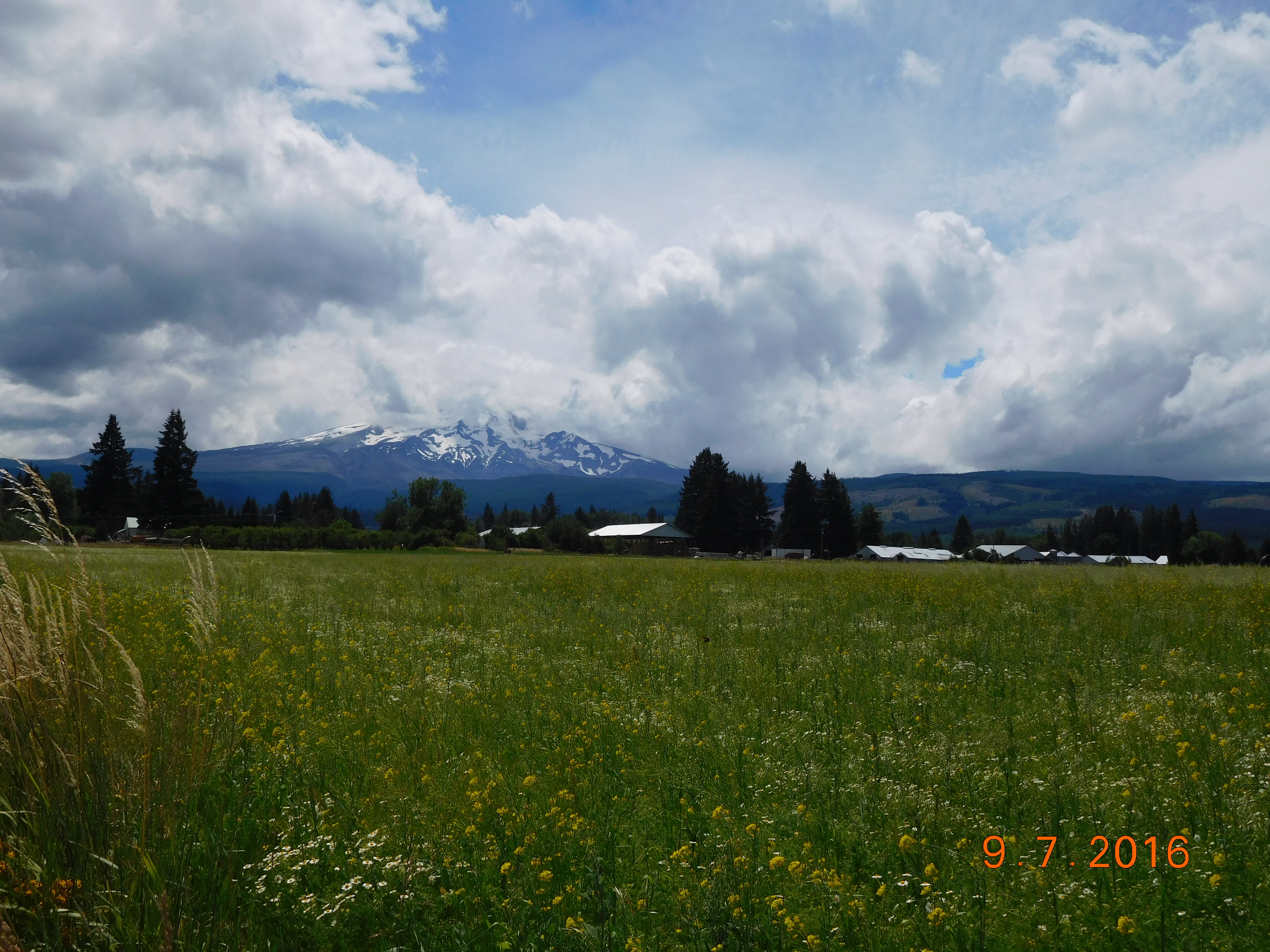 Mount Hood was shrouded in clouds (no surprise there), but I took some pictures anyway. Then we returned to the Sierra Cascades Bike Route, tracking closely the PCT on Forest Service Road 42, a single-lane track winding through the woods and across the ridges. After a terrifying two hours, we reached FS 46, a two-lane road, which led us to Detroit Lake, where we took State Route 22 to Sisters and Tumalo State Park, outside of Bend, Oregon. The campground was full, but we stumbled across a large group that had decided to check out early.
  They let us have their prepaid site. The threatened storm did not materialize, and we spent a pleasant night in quiet surroundings for a change. A robin chick fell out of its nest near our site as the friendly group was preparing to leave. We carefully avoided it, and the ranger who came in response to the call from the previous campers decided to leave it, because the parents were checking on it. Unfortunately, the chick did not survive the night.
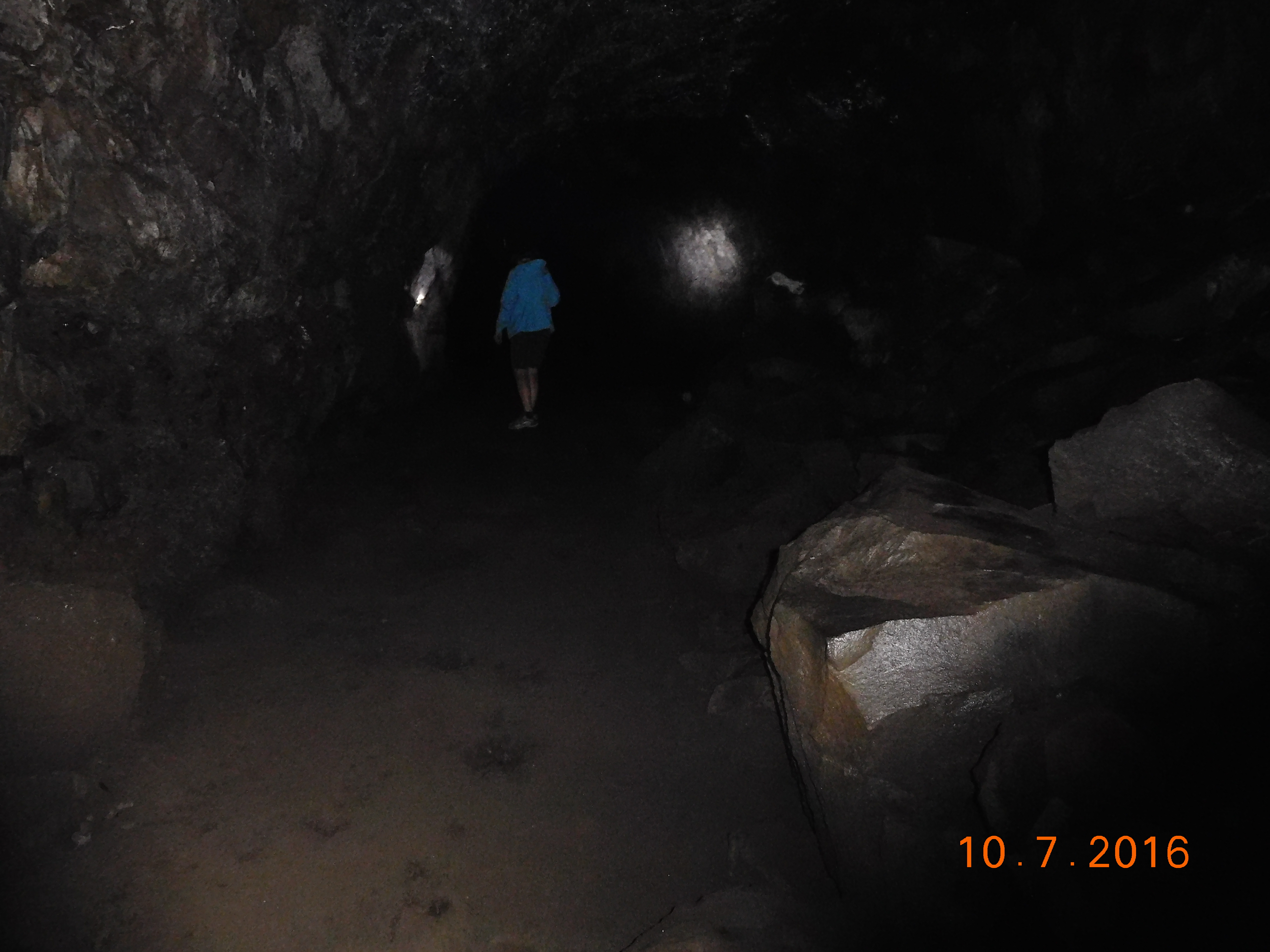 There was a Summer Festival in Bend, so on Sunday, we walked among the kiosks, and had lunch at La Magie, before heading down US 97. Just south of Bend, we stopped at the Lava River Cave, and walked the longest uncollapsed lava tube in the world (2 km). The weather was warm and sunny as we continued down US 97, but the climb up Route 138 to the rim of Crater Lake took us into freezing temperatures and fog so thick we could hardly see the next hairpin turn.
 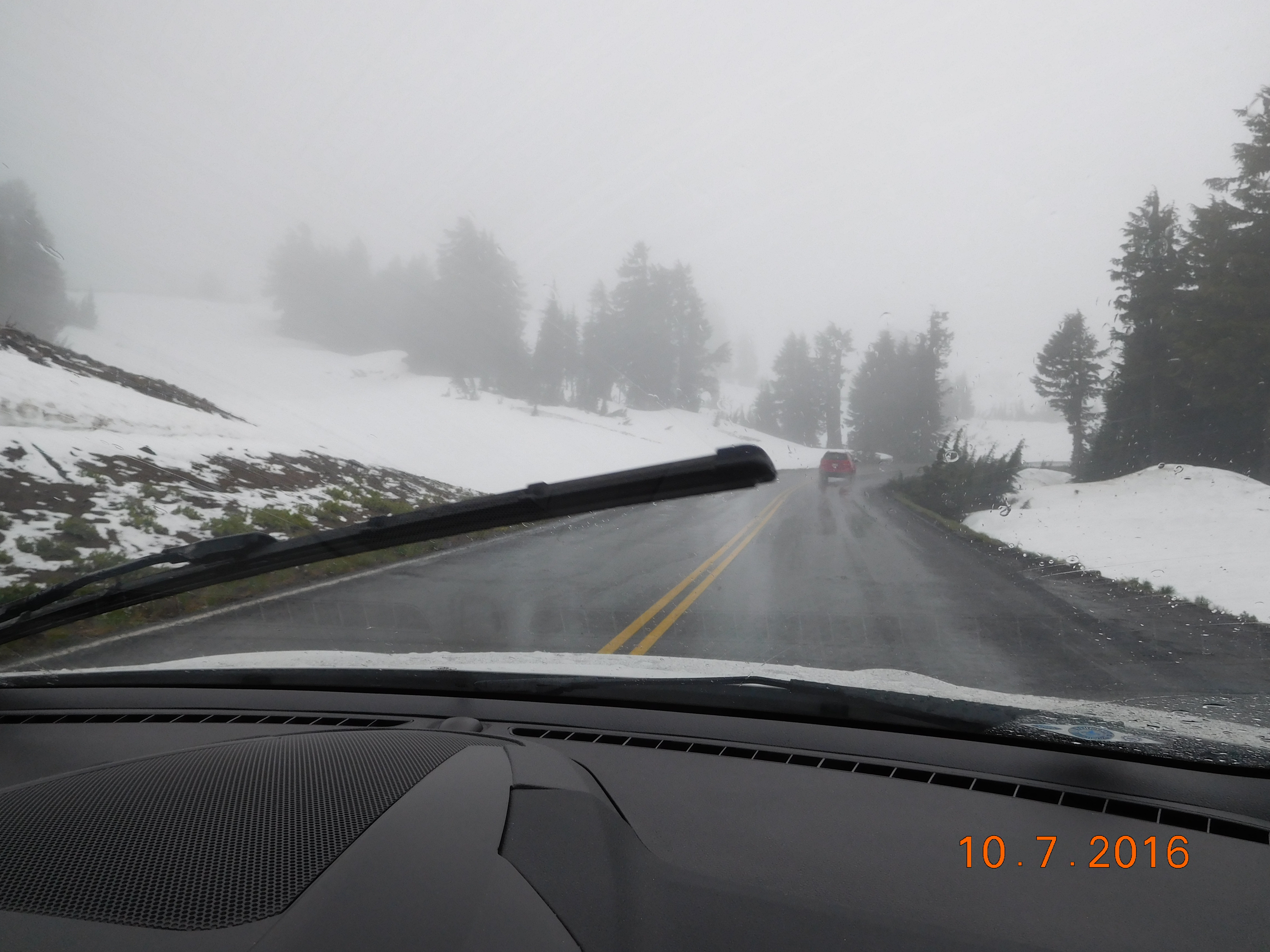 We had reservations at the Manzanita Campground below the rim, but we stopped at the Lodge to see if we could switch. It was filled with luxury bicycle tourists from Backroads and Trek Travel. We drove down to the campground to find that it was essentially inoperative in the freezing rain (no hot water; showers closed). There was no room in Union Creek, but the staff at the one hotel used their landline to get us a reservation at the Prospect Historic Hotel. After dinner at the famous Beckie’s Café in Union Creek, we located the Prospect Historic Hotel, about 17 km from Union Creek. It was a jewel in the wilderness, and we enjoyed a wonderfully appointed room (called the WJB room, because William Jennings Bryant used it when he passed through Prospect).
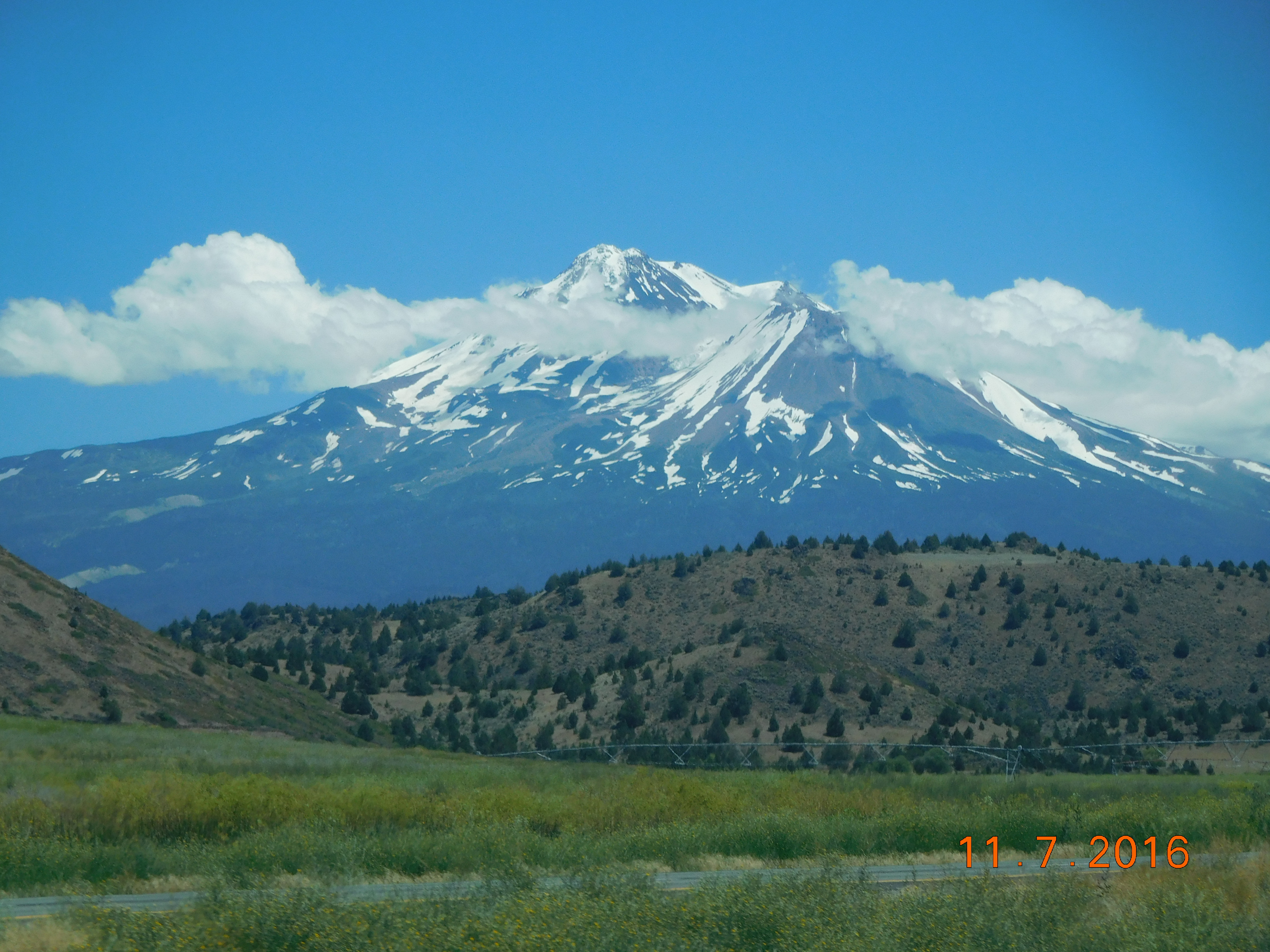 Monday the 10th found us rolling through the town of Mount Shasta and photographing the eponymous volcano. We picked up State Route 89, which would take us to Lassen Volcanic National Park and Lake Tahoe. We stopped in the McArthur State Park, and hiked down to Burley Falls.
 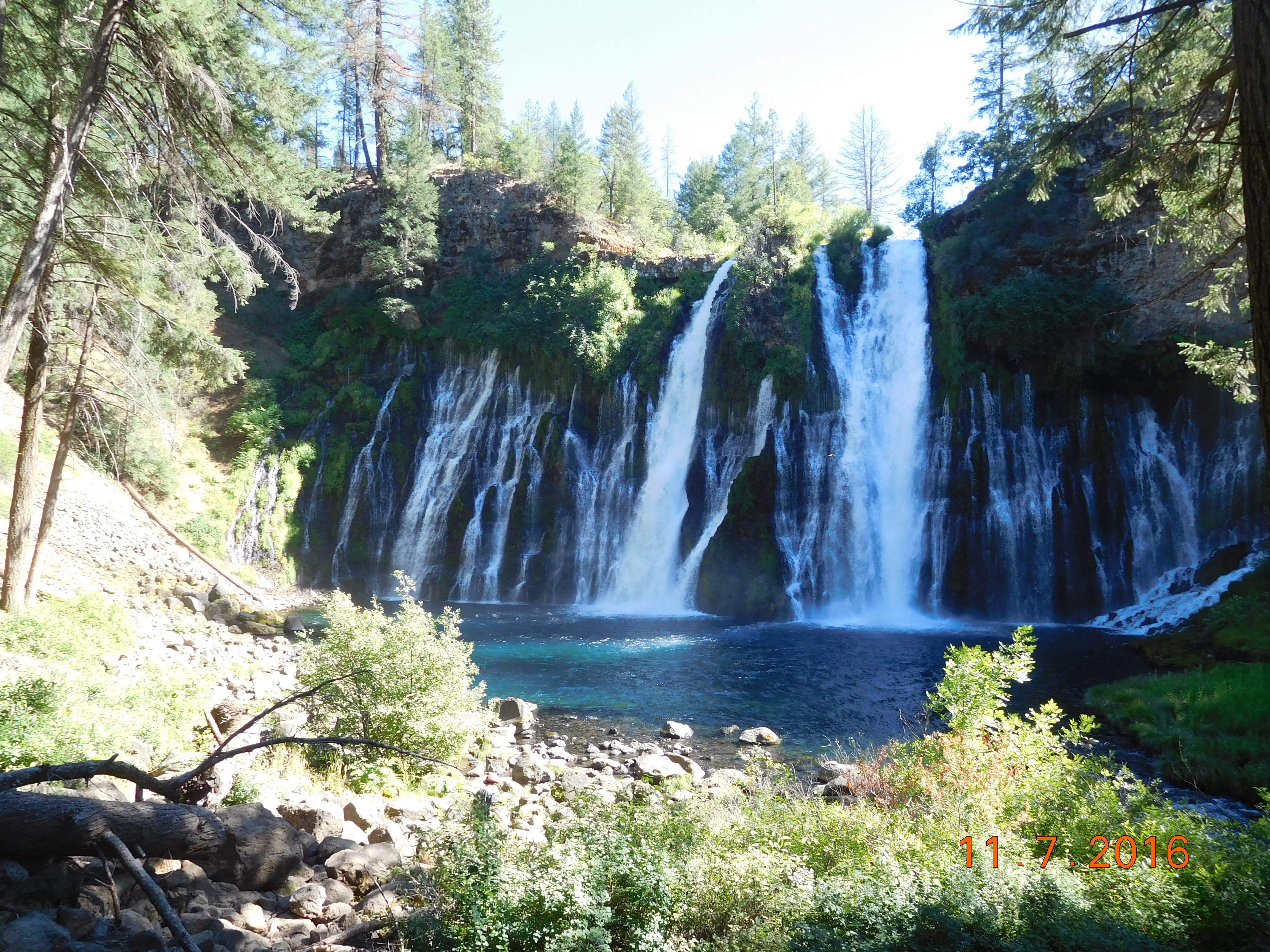 We arrived at Lassen in time to set up camp early, which was good. It was cold in Lassen, too, but we enjoyed clear air and a cozy tent.
On Tuesday, we broke camp early and drove around the park. 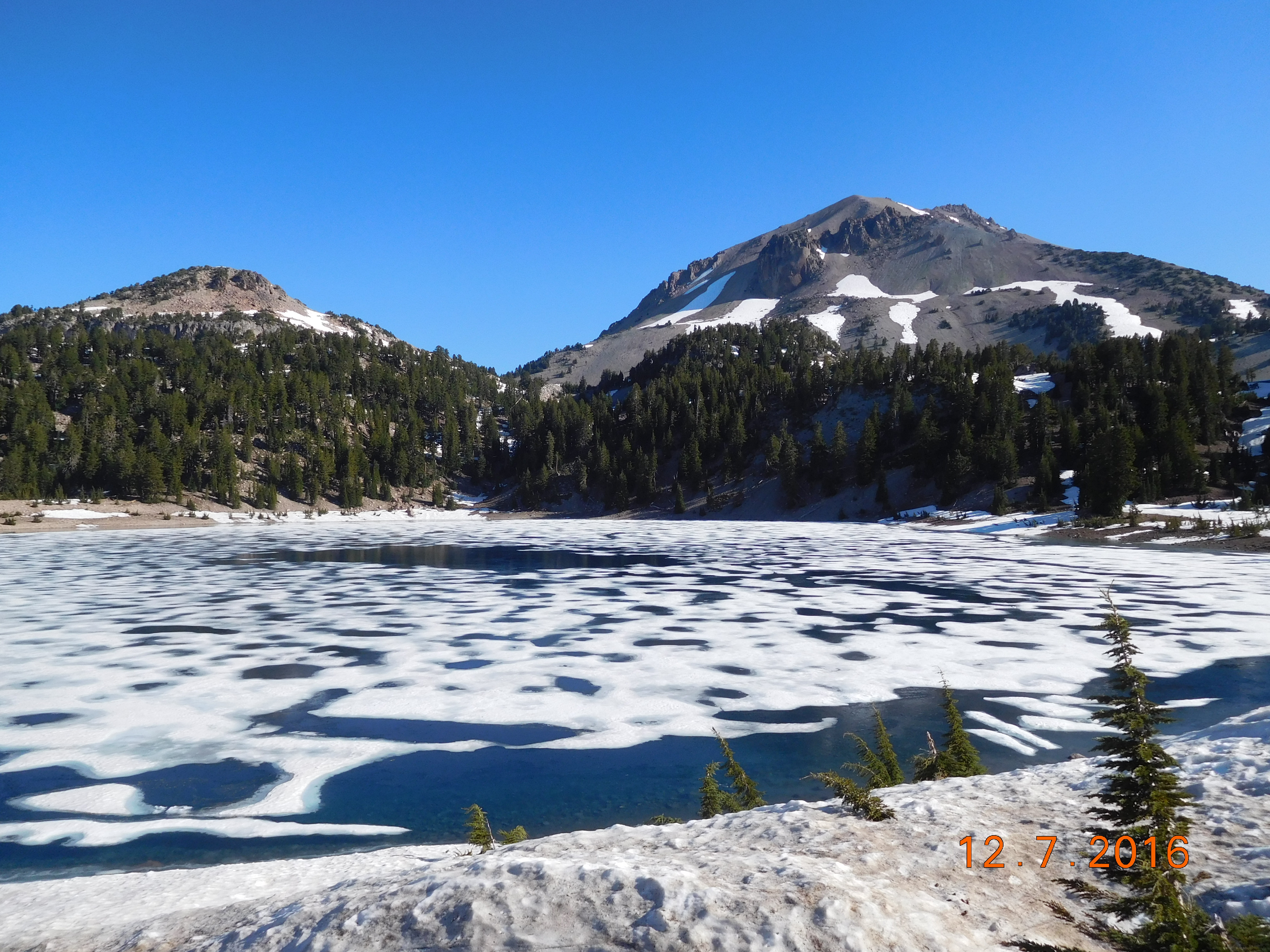 Lassen Volcanic was arguably my favourite place of the tour, the only place on earth with all four types of volcanoes in one location (cinder cone, plug dome, shield and composite). Its activity spans many millennia, but so many eruptions are recent that scientists use it to figure out what will happen with other volcanic sites, like Mount Saint Helen.
 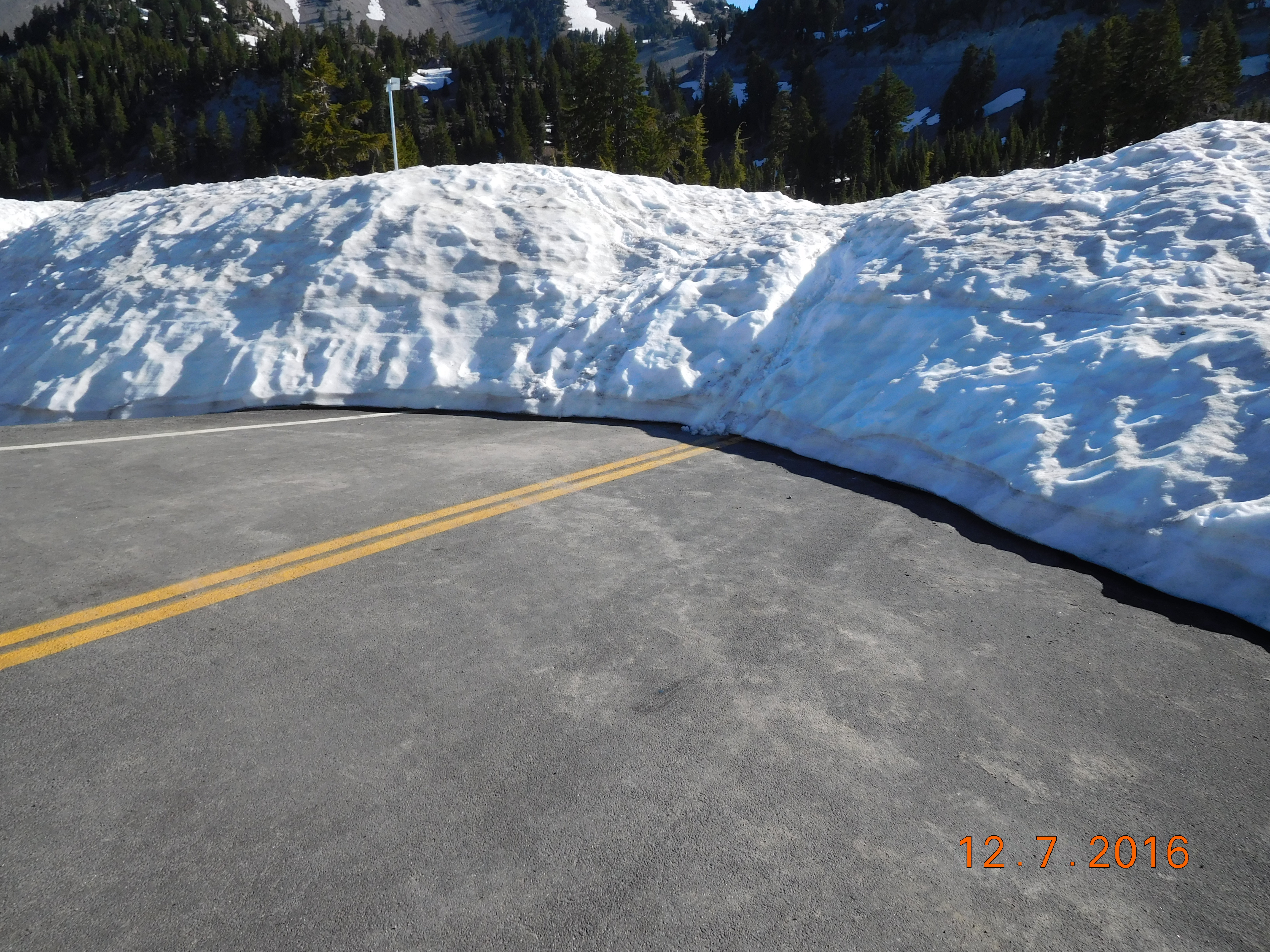 It was weird to park among so much snow in July, but that is the nature of a desolate place at 2133 meters. With unlimited visibility and a bright sun, we could enjoy the vistas at Lassen to their fullest. We had breakfast on the other side, then continued on SR 89 to Lake Tahoe.
 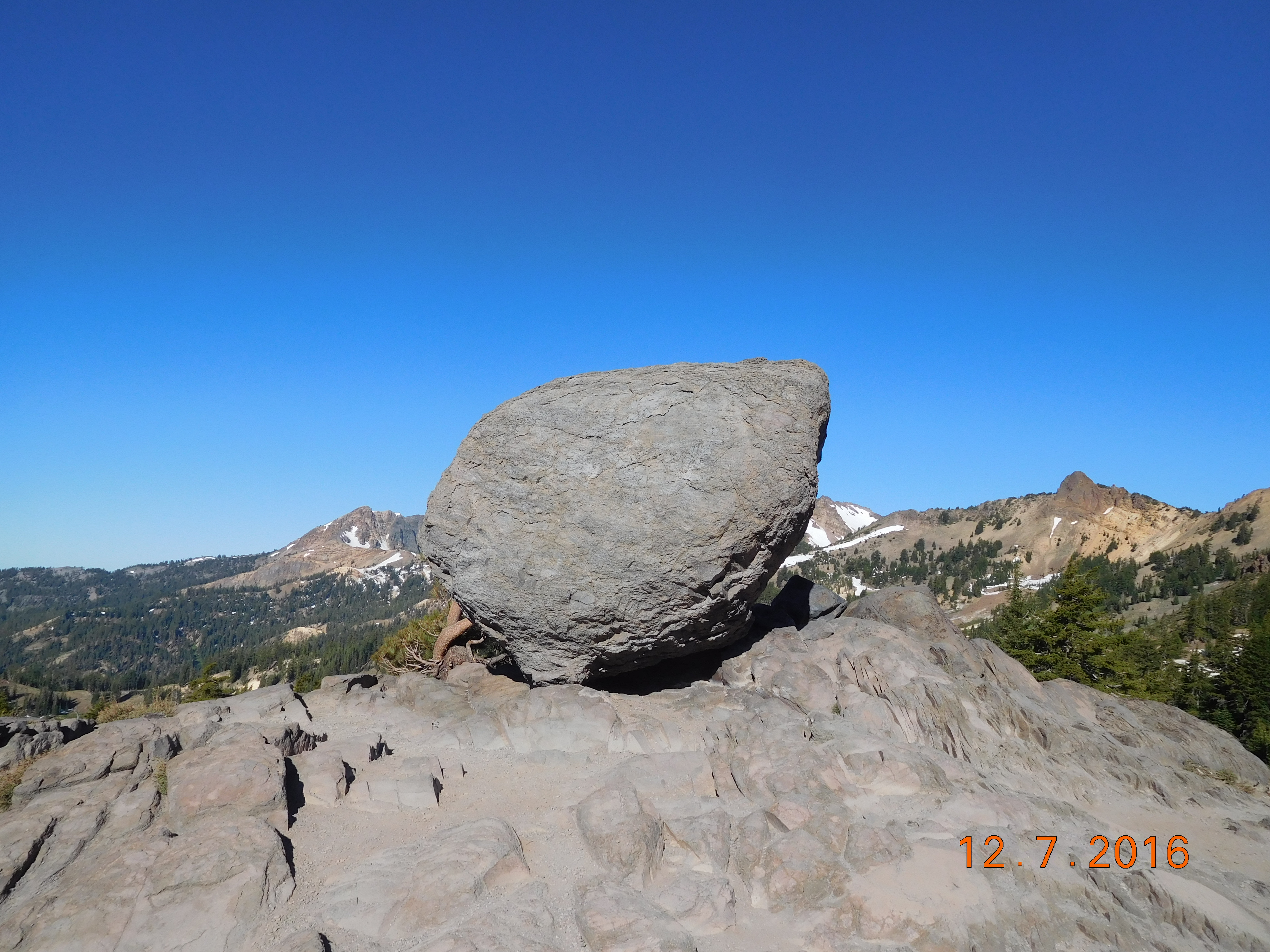 After a snack in Truckee, we checked out downtown Tahoe City, then camped at Ed Z’berg Sugar Pine Point State Park.
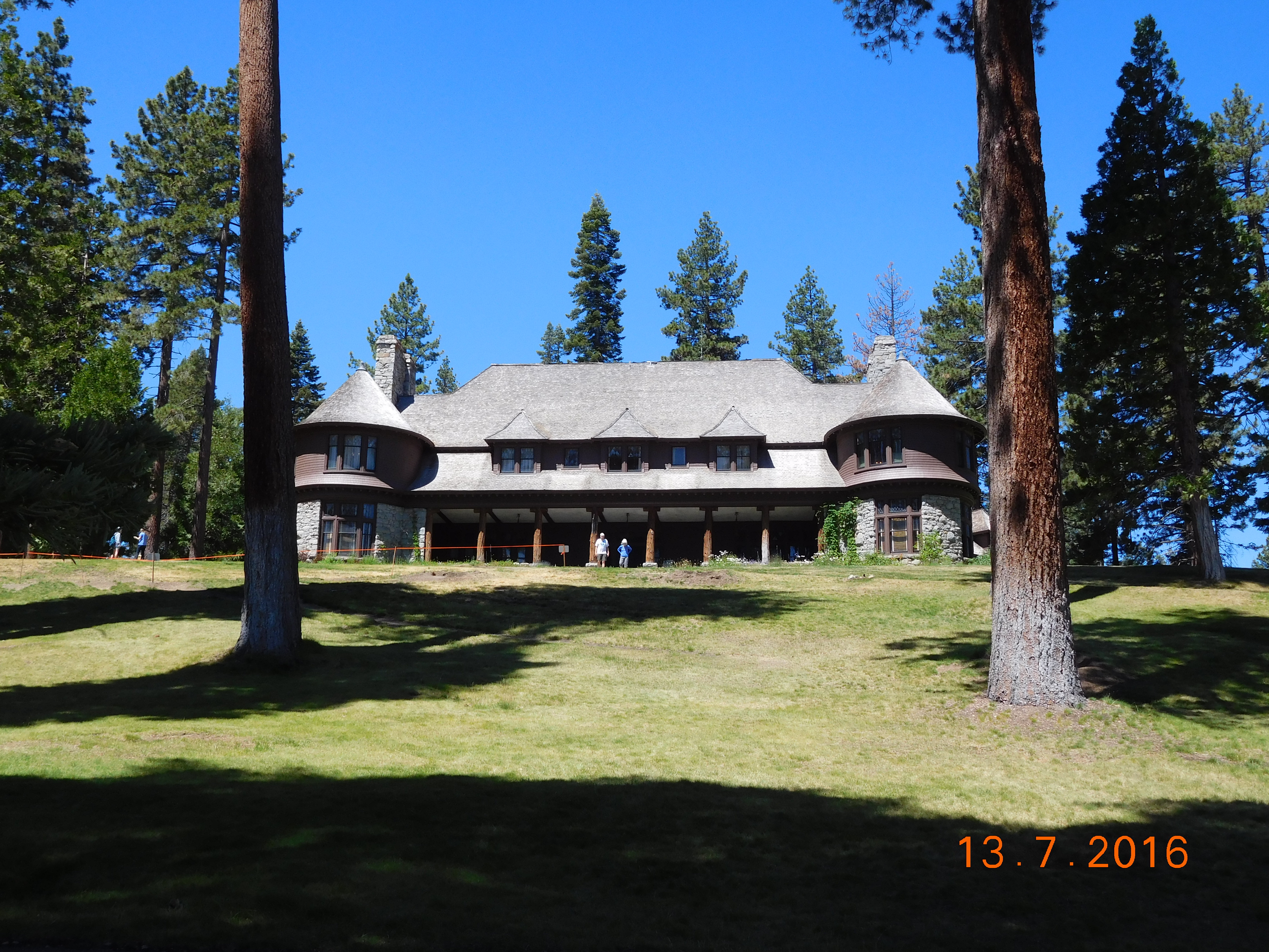 On Wednesday 13th, we walked over to the Pine Lodge side of the park, between SR 89 and the lake.
 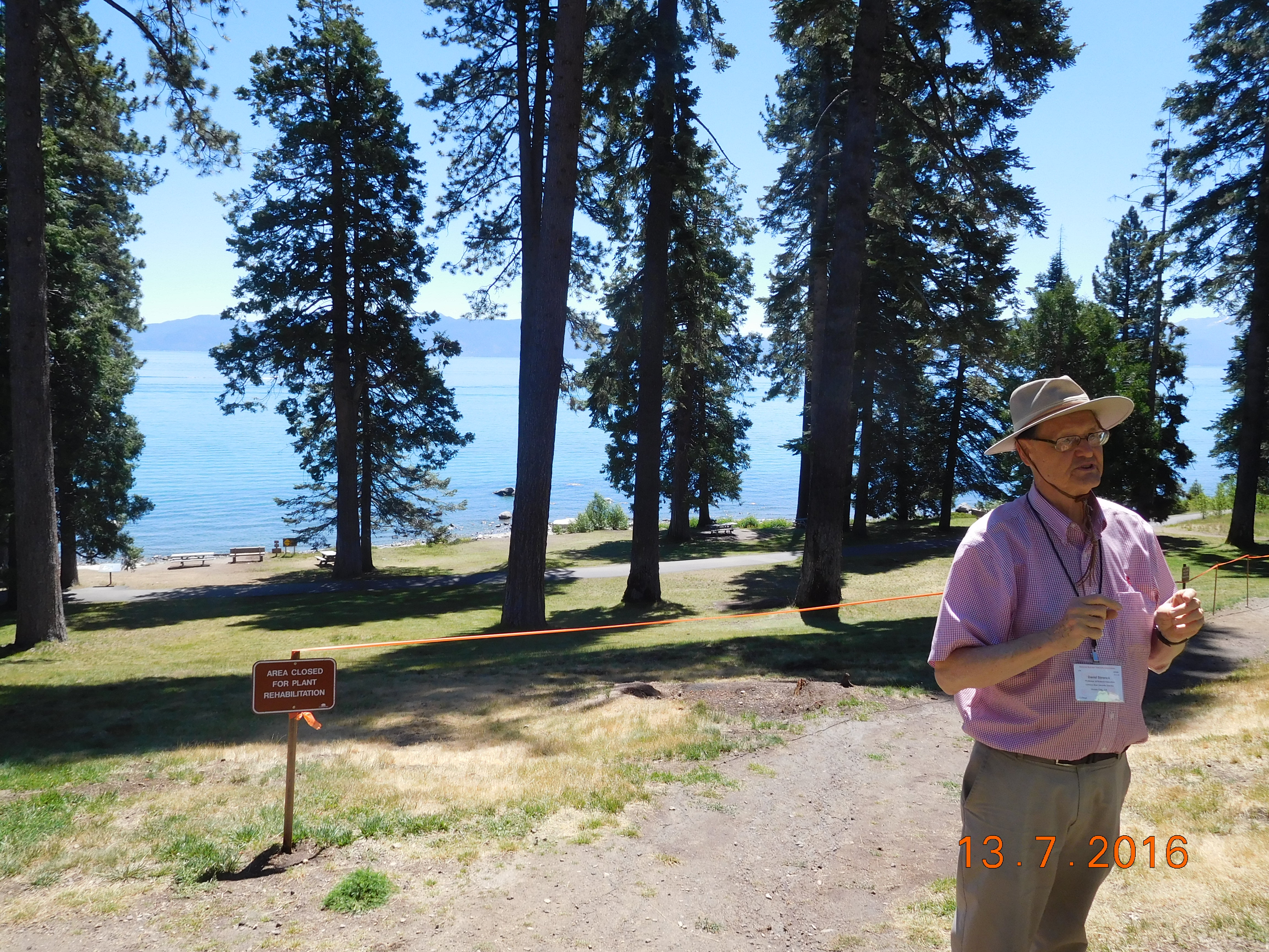 David Stronck had just started a very interesting tree identification workshop, which included a walk around the beautiful grounds.I enjoyed learning how to identify what we would be seeing, especially considering the uniqueness of the different species (redwoods, sequoias, incense cedars, pines, red and Douglas firs, hemlocks, etc.). We had stayed in Sugar Pine Point State Park rather longer than we intended, but we stopped at D.L. Bliss State Park anyway.
 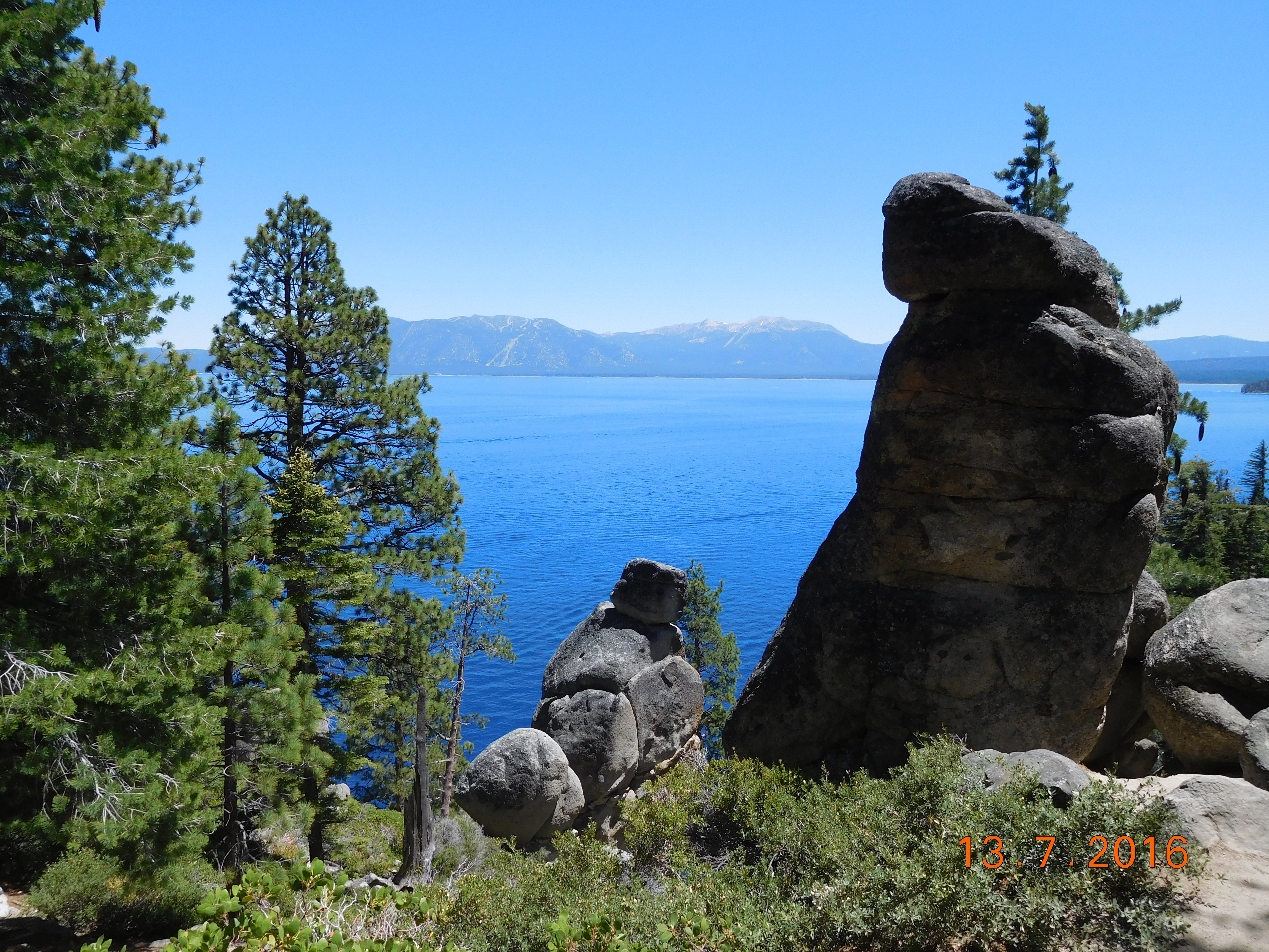 This large park does not allow recreational vehicles, and boasts a challenging series of trails along the coast. We hiked half wa
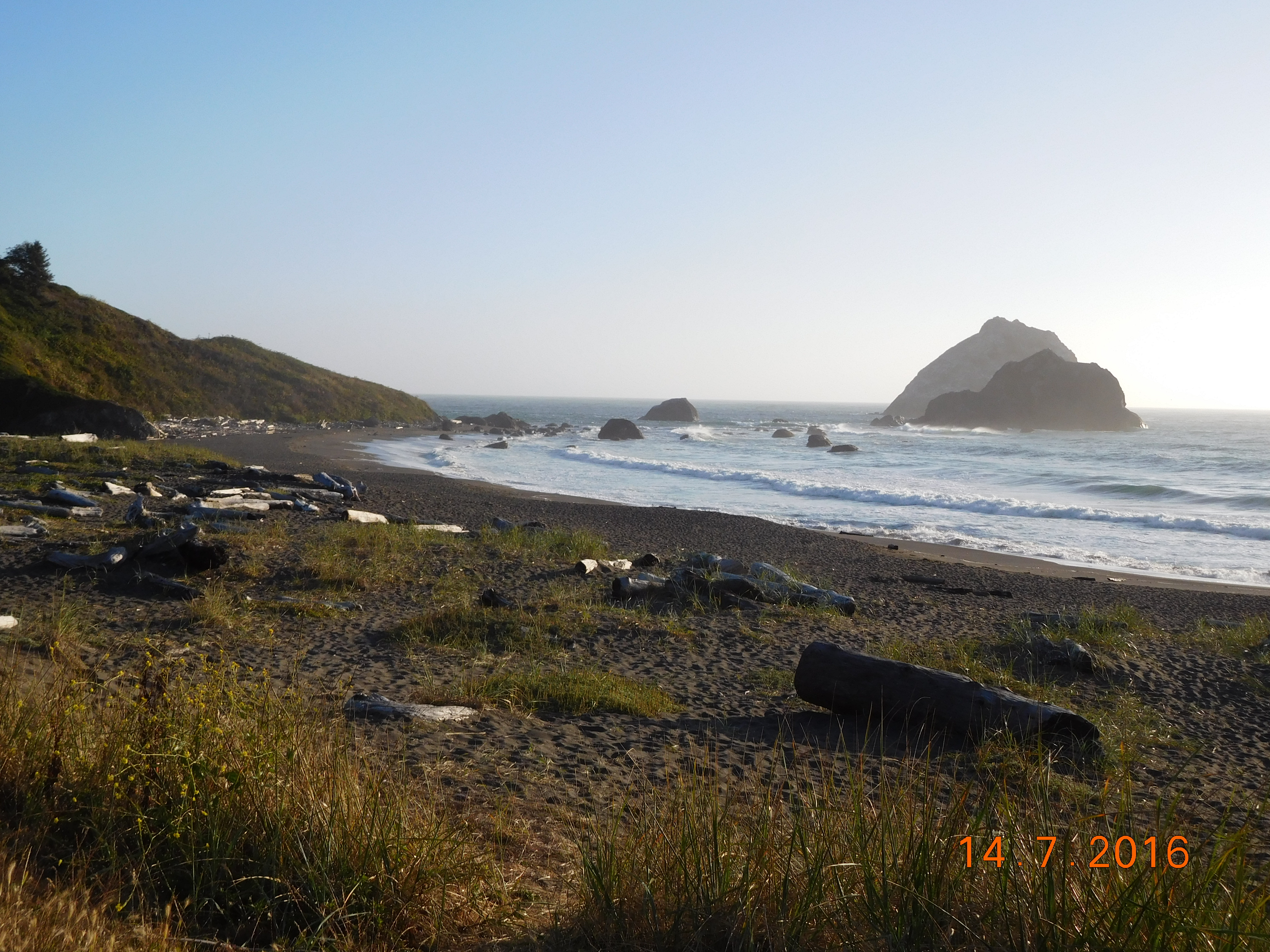
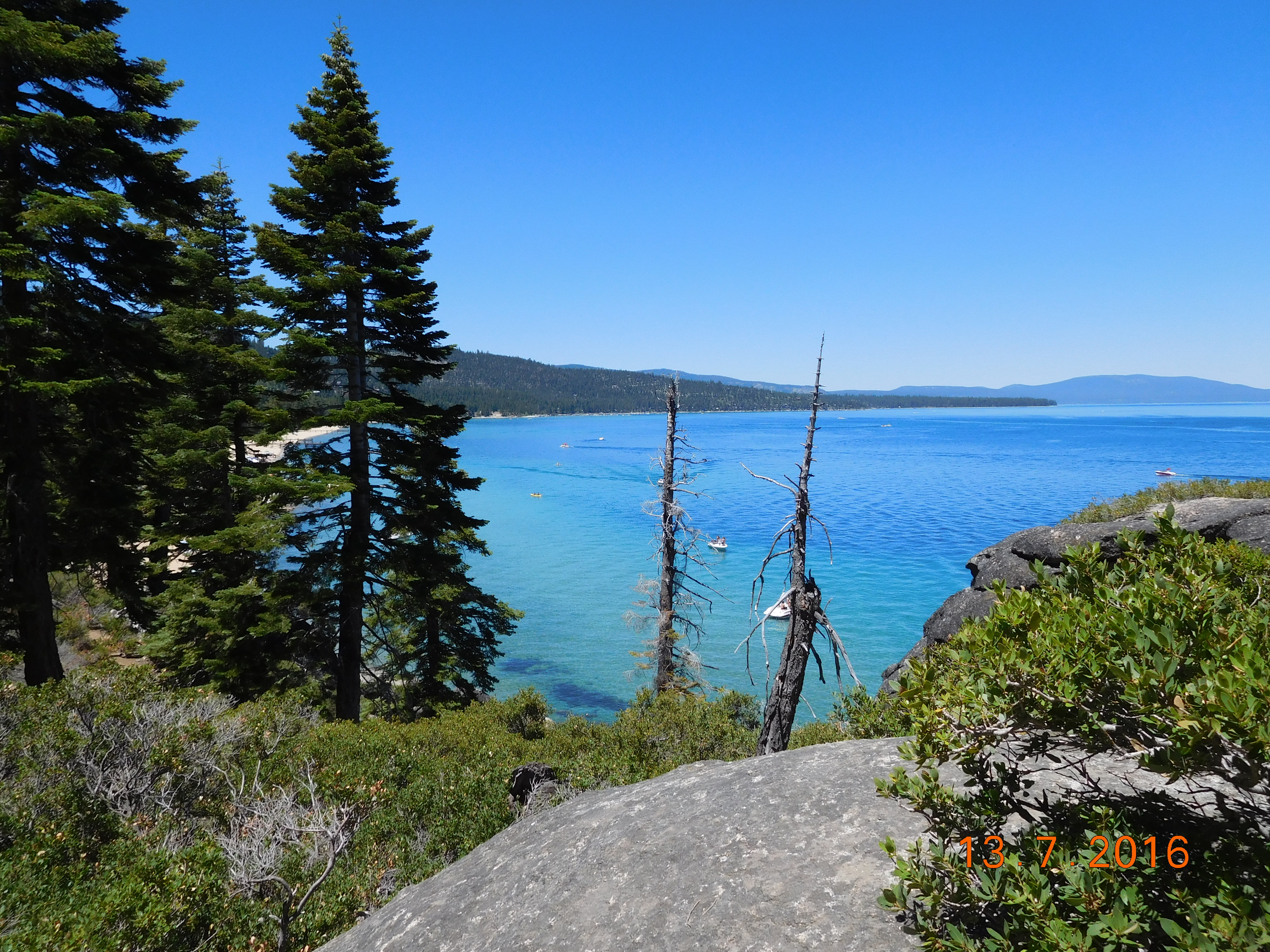 y to Emerald Bay before turning around and returning to the car. Hitting the road again, we stopped at Emerald Bay, and South Lake Tahoe, where we picked up supplies for our return trip. The scenic part of the drive ended when US 50 approached the Sacramento suburbs. The sun went down as we crossed the misty marshes around Sears Point Road north of San Francisco.
  By the time we pulled up to the Vintage Towers Inn in Cloverdale, Cheryl had driven 688 km from Sugar Pine Point State Park on Lake Tahoe. A fairy tale adventure in luxury and gracious hospitality awaited us. The room was beautifully appointed with no comfort overlooked. Breakfast the next morning was served with the style of a formal dinner, and included delicious and complete fare.
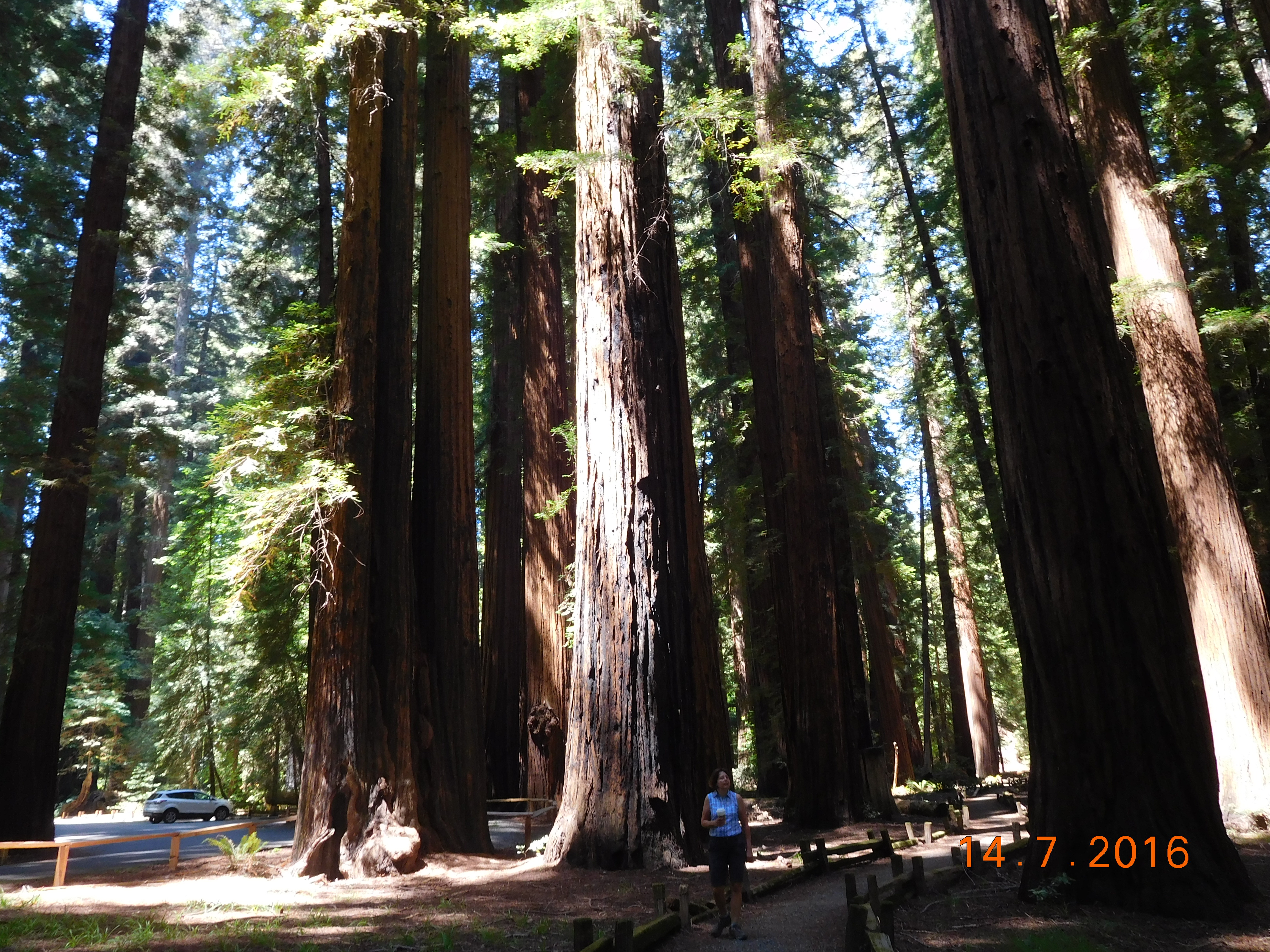 Refreshed and refueled on Thursday morning, we drove through the redwoods: Humboldt Redwoods State Park and the two sites of the Coastal Redwoods State Park. The photographs you have seen (including mine) cannot do justice to the majesty and awe-inspiring sight of the great redwoods of California.
 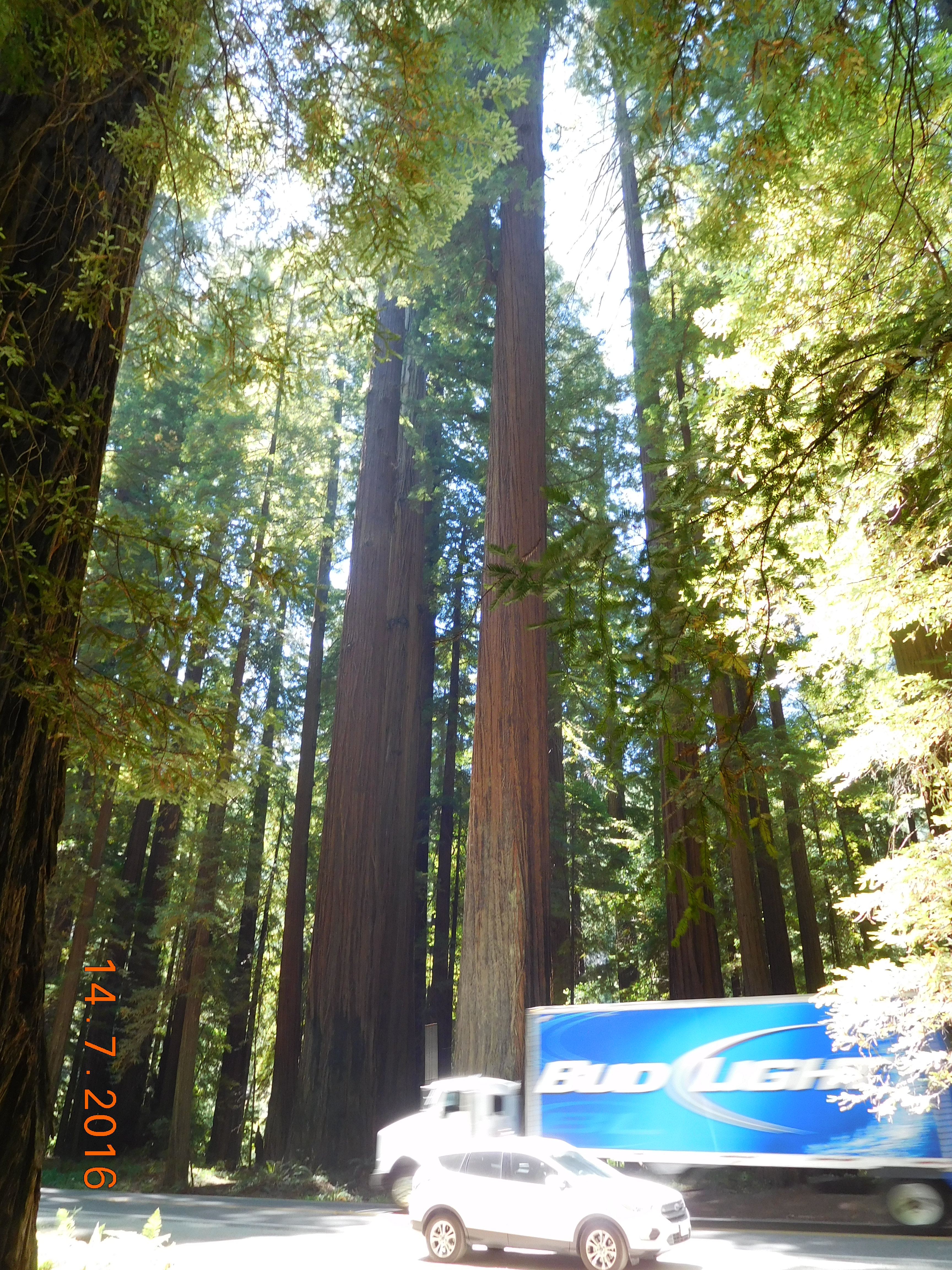 The big ones are thousands of years old, and reach hundreds of meters into the sky. There is no way to capture them except by the human eye. We camped among the giants at Mill Creek in the Del Norte Coastal Redwood State Park.
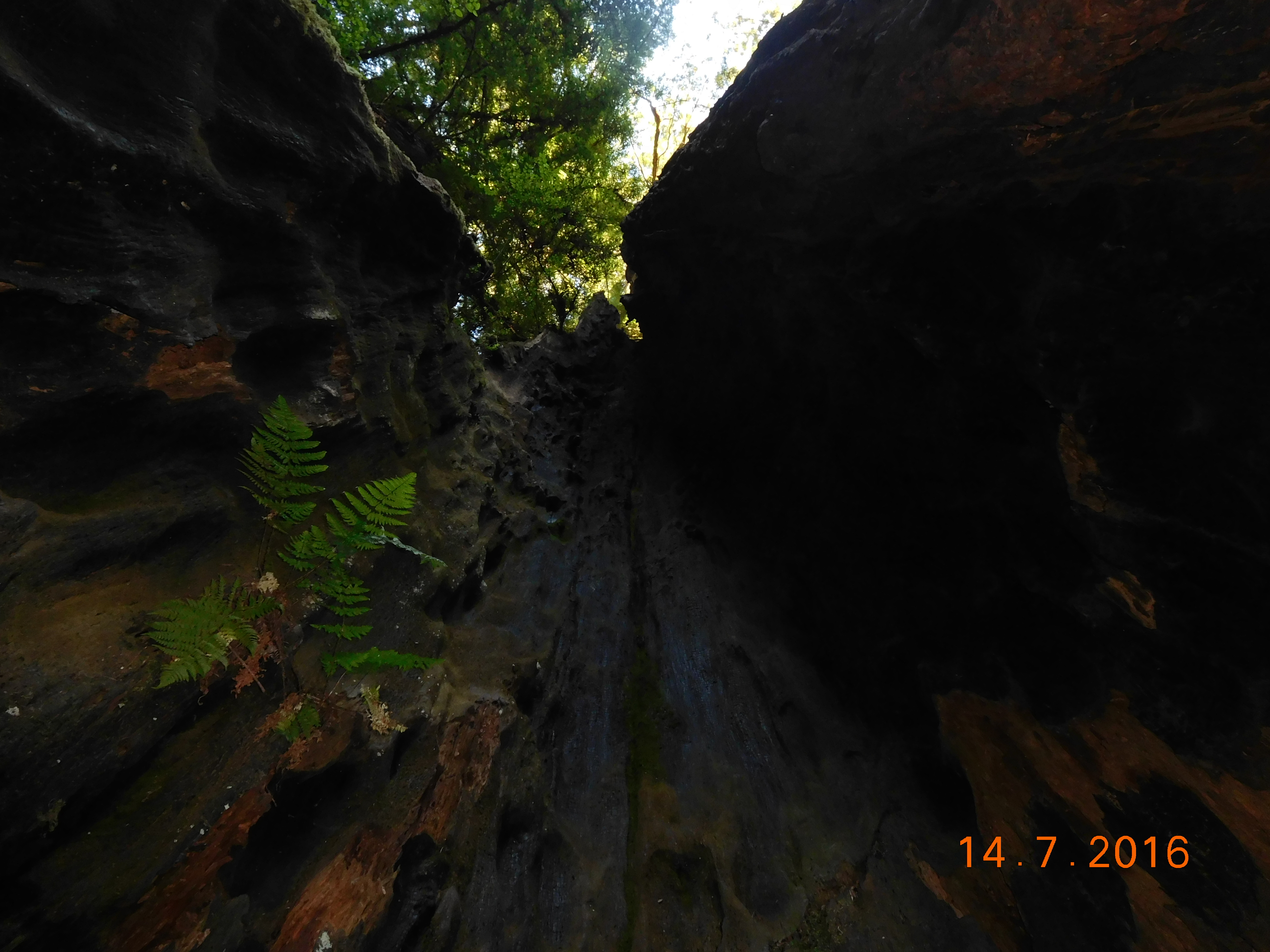 Friday the 15th was our last day. We broke camp early and headed for Jedediah Smith State Park, where the redwoods were just as impressive, but the feel of the forest was different. In this part of the Coastal Redwoods State Park, the trees were spaced apart in cleaner groves, and there were fewer “fire ladders” (Douglas firs that carry flames in the brush up to the canopy and kill the redwoods that could otherwise survive a wildfire).
 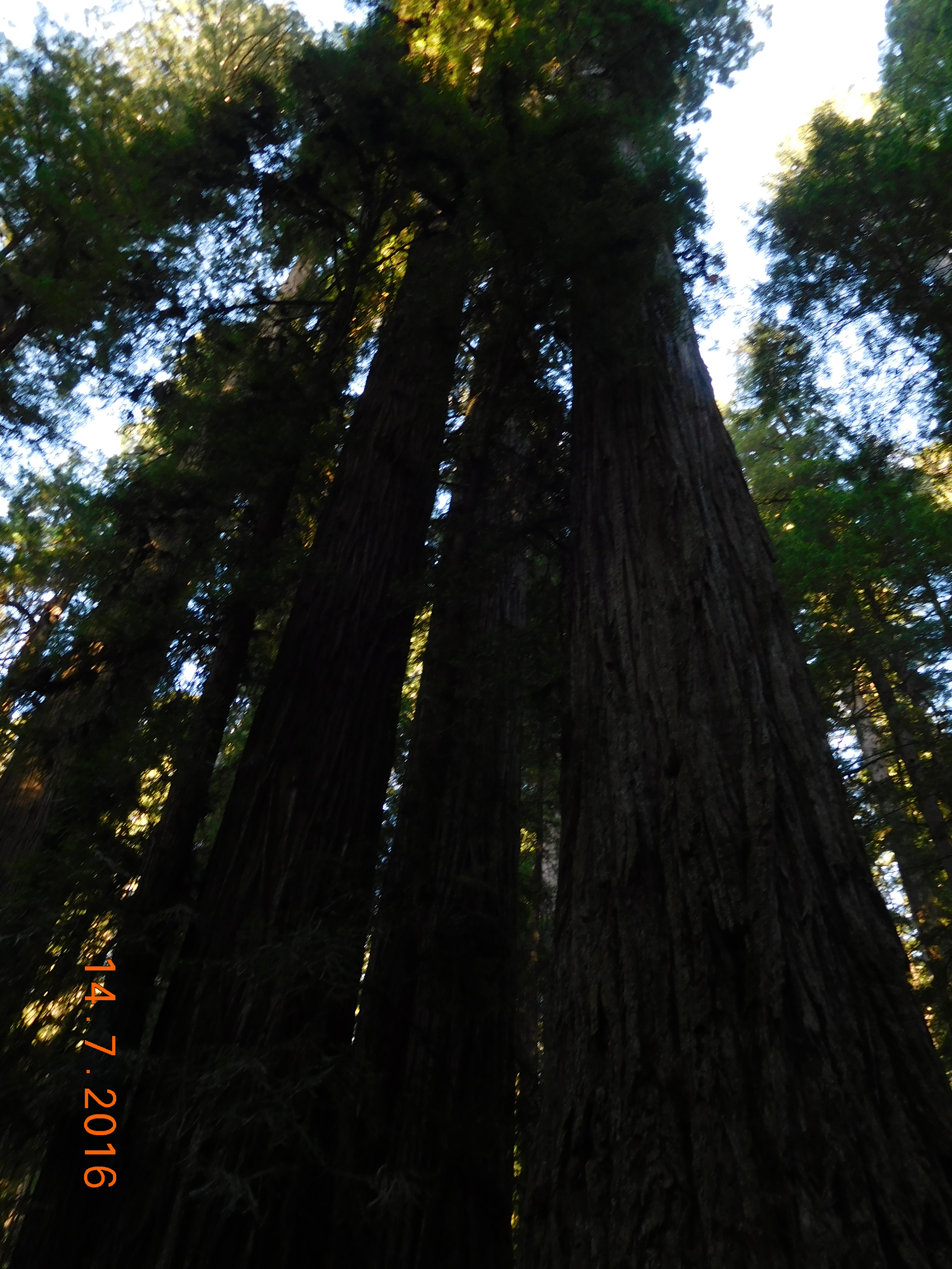 Then we made the long drive home through Northern California, Oregon and Washington, stopping only to buy groceries at Costco and some camping gear at REI. We crossed the Canadian border at midnight. Cheryl returned the rental car to the airport, while I put the contents of the car away at the house. We ended our Northwest adventure last Saturday morning at 0304.
 For the ten days of the trip, we had no electrical power, cellphone service or Wi-Fi whenever we were in National or State Parks, on Forest Service roads, or in the National Forests. That was almost the entire time. We cleared our email on our phones when we passed through towns for gas and food. I had not planned to be so out of touch, but I cannot regret it. The chance to see those forests, mountains, deserts, lakes, and coasts was worth it. Now back to work.
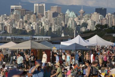 Last weekend, we attended the Vancouver Folk Festival, which has been an institution in the folk music circuit for 39 years. It includes music that crosses over to rock and country (as does most folk music), and the world music groups from Haiti, Mexico, Morocco, Spain, Bulgaria, and other places provided fantastic entertainment.
 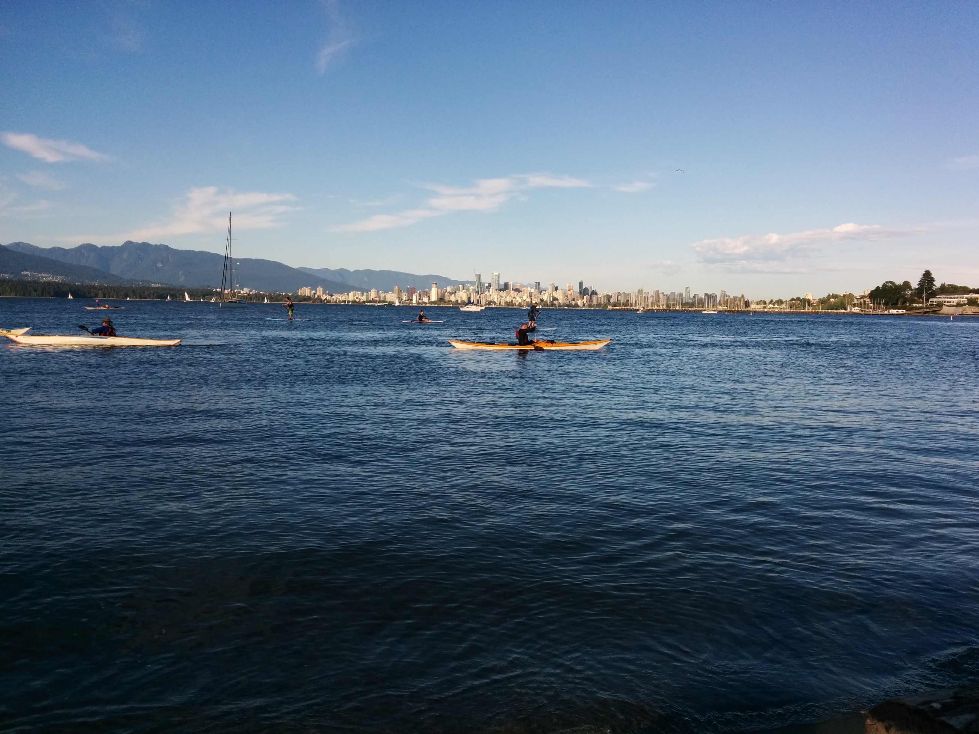 We have been riding every day, getting our cycling legs back. And I have returned to my routine of translating and writing.
Next week, another sea story (unless you want to read about something else – or I have another adventure!). Then back to the subject of living and working on the road.
As always, I look for your feedback, and welcome any comments you want to share with the other readers.
Smooth roads and tailwinds,
Jonathan.

Right now I can think of one word: envy! I wish I could be there with you to enjoy all that. I had the pleasure of experiencing North Bend, bend and South Bend in 1982 (gosh!!). Had so much fun! Than went down Redwood State park in a Greyhound bus. Lovely trip. You have awaken the memories and I want to live them again, Jonathan! Except for the pregnancy part (I was 5 months pregnant then).
We can tell you enjoyed it by your word choices and the liveliness in your sentences. Thank you!
LikeLiked by 1 person
A lovely comment, Gio. Thanks.
LikeLike